


Maya Copan 2011


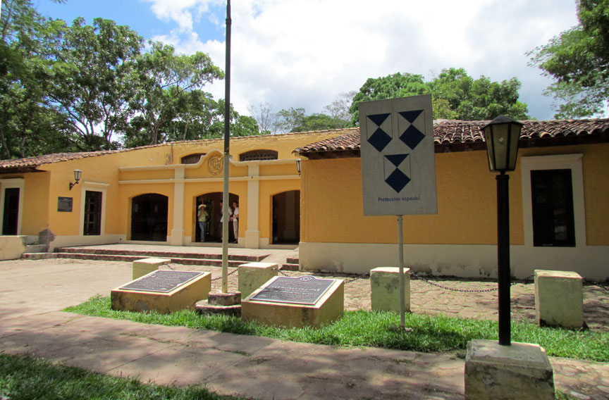
Visitor Center
Copán is an archaeological site of the Maya civilization located in the Copán Department of western Honduras, not far from the border with Guatemala. It was the capital city of a major Classic period kingdom from the 5th to 9th centuries AD. The city was located in the extreme southeast of the Mesoamerican cultural region, on the frontier with the Isthmo-Colombian cultural region, and was almost surrounded by non-Maya peoples. In this fertile valley now lies a city of about 3000, a small airport, and a winding road.
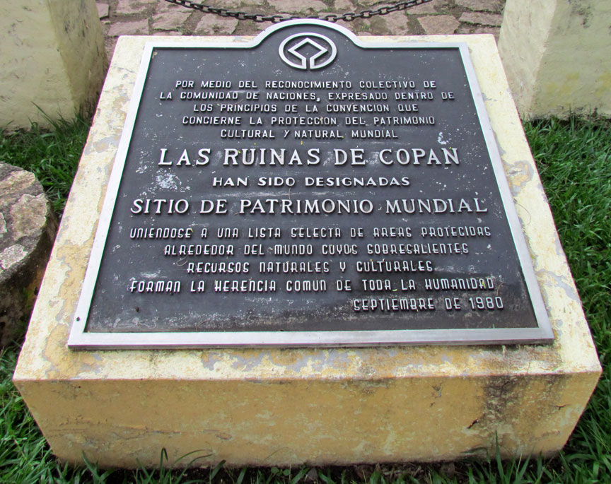
World Heritage site
Copán was occupied for more than two thousand years, from the Early Preclassic period right through to the Postclassic. The city developed a distinctive sculptural style within the tradition of the lowland Maya, perhaps to emphasize the Maya ethnicity of the city's rulers.
The city has a historical record that spans the greater part of the Classic
period and has been reconstructed in detail by archaeologists and epigraphers.
Copán, probably called Oxwitik by the Maya, was a powerful city ruling a vast
kingdom within the southern Maya area. The city suffered a major political
disaster in AD 738 when Uaxaclajuun Ub'aah K'awiil, one of the greatest kings in
Copán's dynastic history, was captured and executed by his former vassal, the
king of Quiriguá. This unexpected defeat resulted in a 17-year hiatus at the
city, during which time Copán may have been subject to Quiriguá in a reversal of
fortunes.
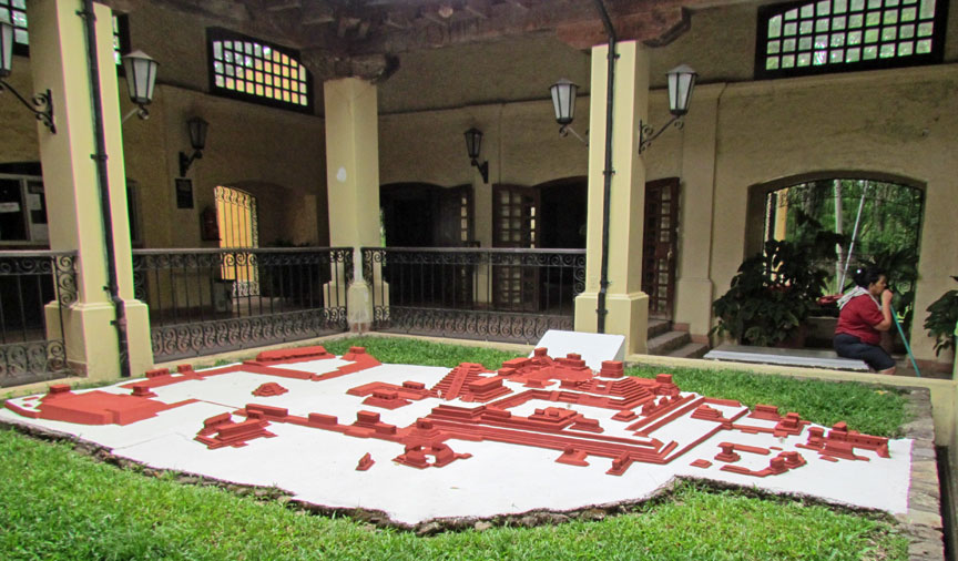
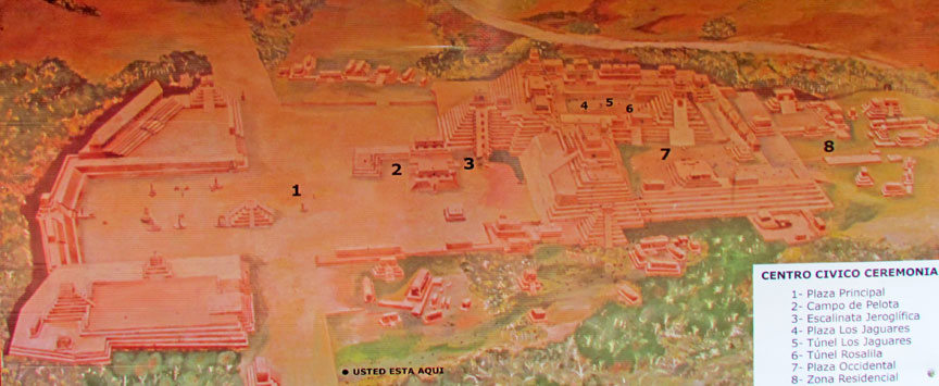
model of the site
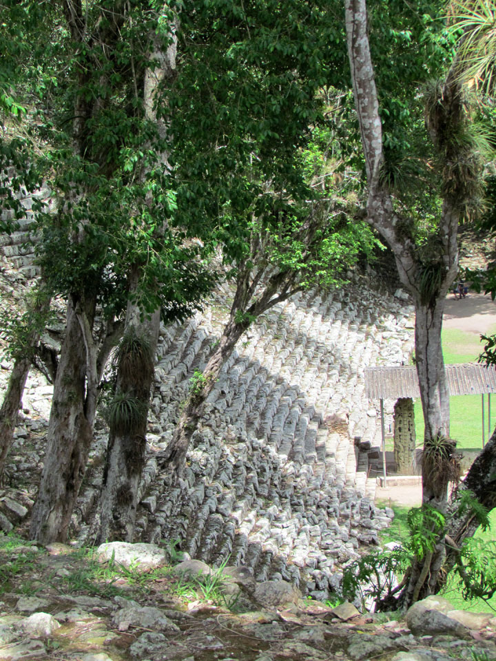
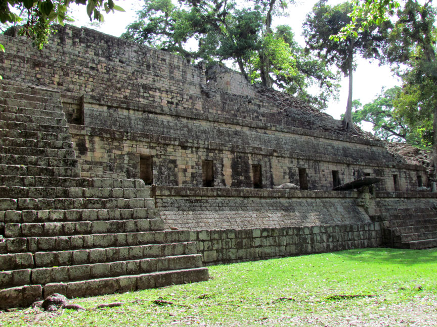
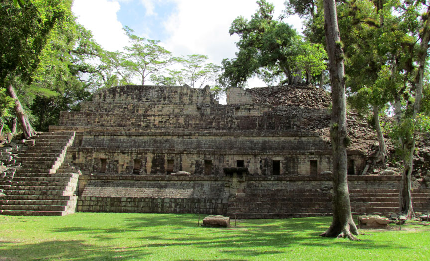
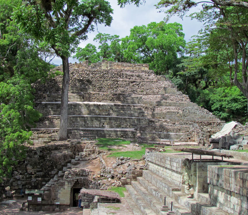
A significant portion of the eastern side of the acropolis has been eroded away by the Copán River, although the river has since been diverted in order to protect the site from further damage.
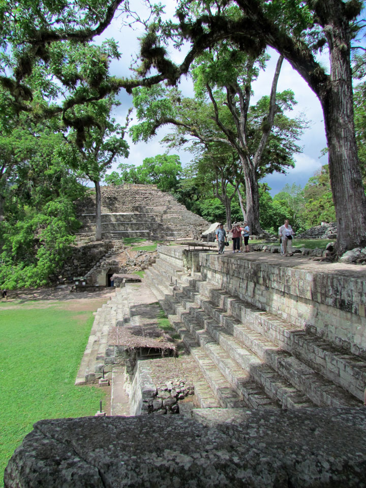
walk to the site
Copán is located in western Honduras close to the border with Guatemala. Copán lies within the municipality of Copán Ruinas in the department of Copán. It is situated in a fertile valley among foothills at 700 meters (2,300 ft) above mean sea level.[2] The ruins of the site core of the city are located 1.6 kilometers (1 mi) from the modern village of Copán Ruinas, which is itself built on the site of a major complex dating to the Classic period.In the Preclassic period the floor of the Copán Valley was undulating, swampy and prone to seasonal flooding. In the Early Classic, the inhabitants flattened the valley floor and undertook construction projects to protect the architecture of the city from the effects of flooding.
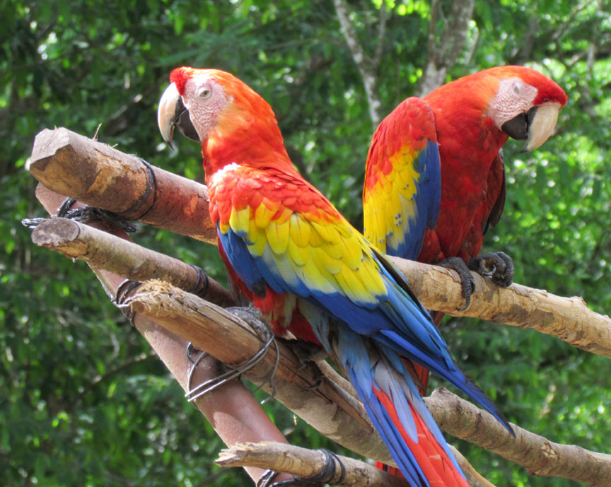
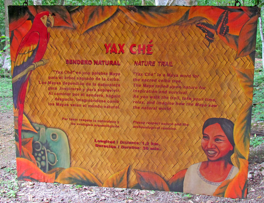
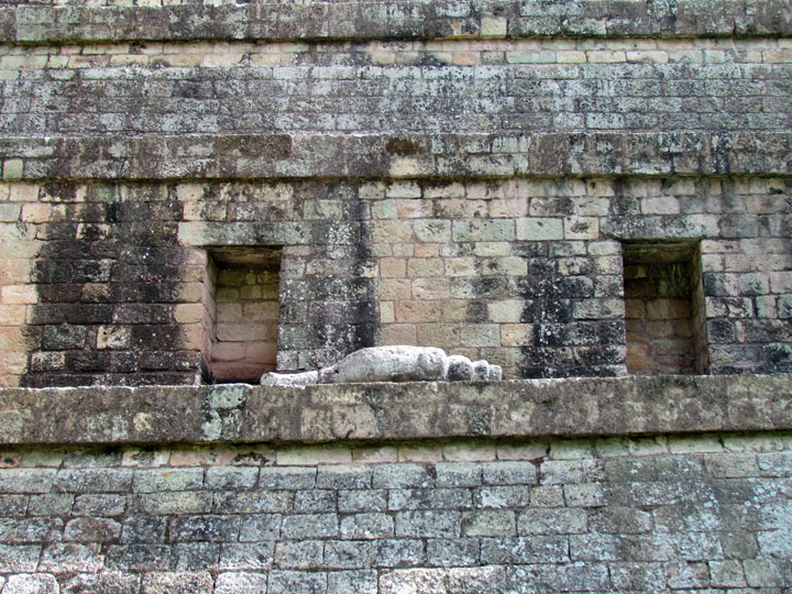
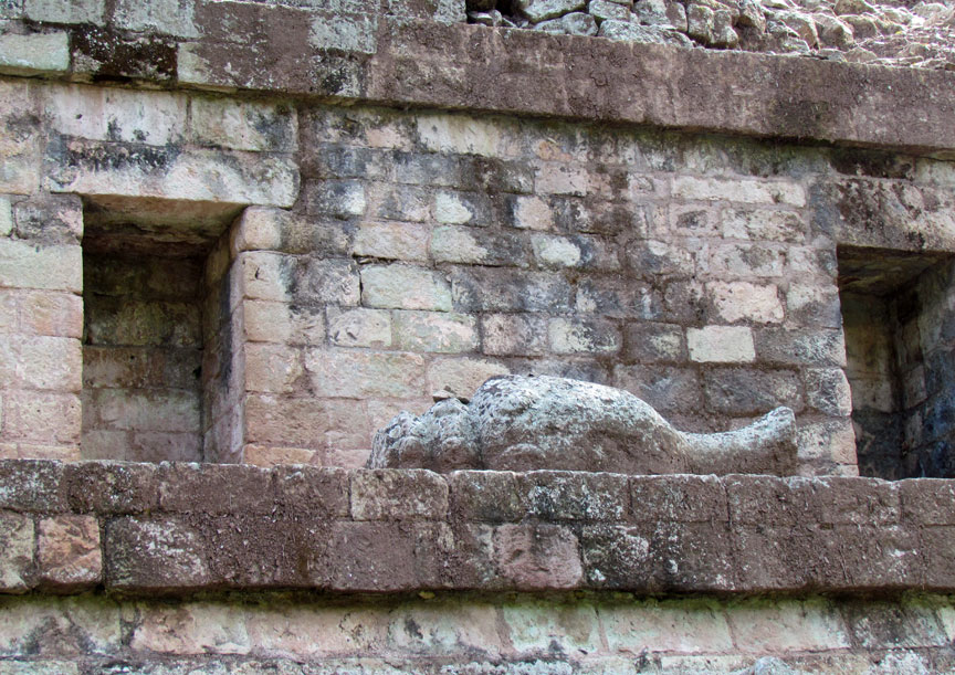
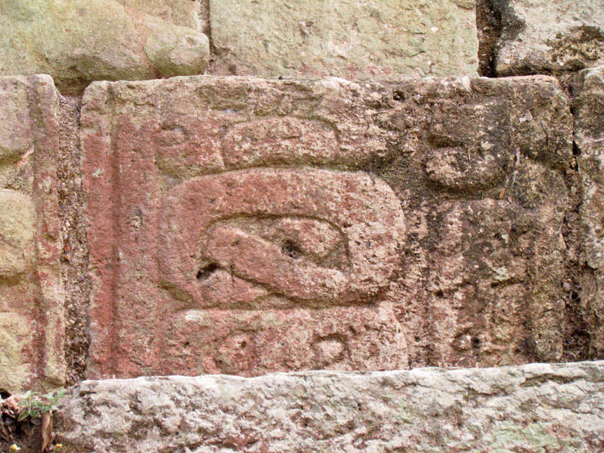
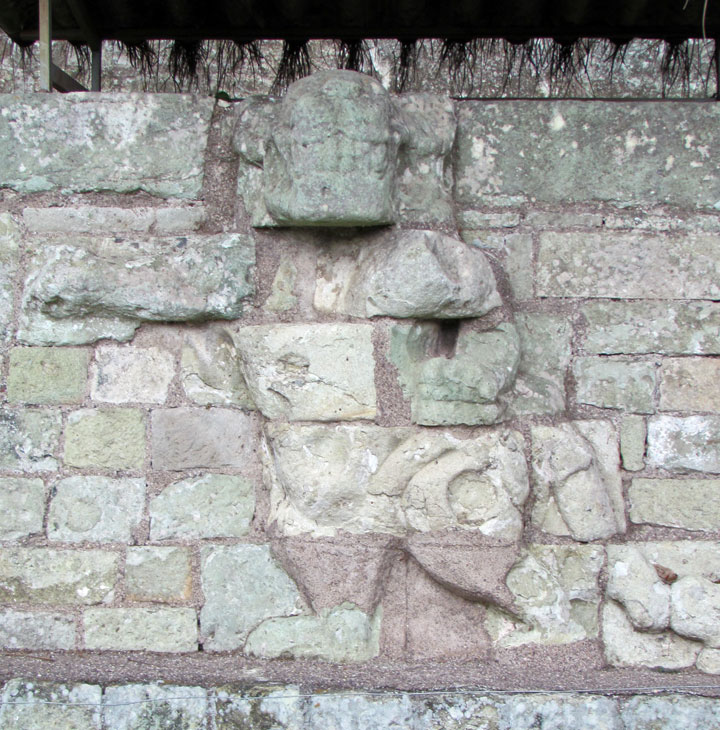
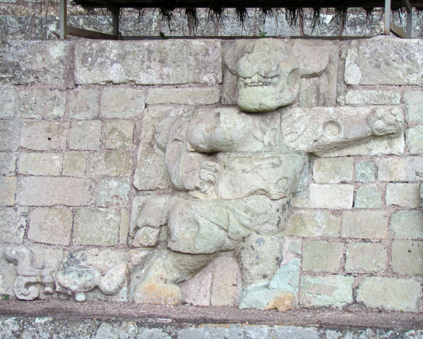
guard Macaws
At the peak of its power in the Late Classic the kingdom of Copán had a population of at least 20,000 and covered an area of over 250 square kilometers (100 sq mi). The greater Copán area consisting of the populated areas of the valley covered about a quarter of the size of the city of Tikal. It is estimated that the peak population in central Copán was between 6000 to 9000 in an area of 0.6 square kilometers (0.23 sq mi), with a further 9000 to 12000 inhabitants occupying the periphery—an area of 23.4 square kilometers (9.0 sq mi). Additionally, there was an estimated rural population of 3000 to 4000 in a 476 square kilometers (184 sq mi) area of the Copán Valley, giving an estimated total population of 18,000 to 25,000 people in the Copán Valley during the Late Classic period.
Little is known of the rulers of Copán before the founding of a new dynasty with
its origins at Tikal in the early 5th century AD, although the city's origins
can be traced back to the Preclassic period. After this, Copán became one of the
more powerful Maya city states and was a regional power in the southern Maya
region, although it suffered a catastrophic defeat at the hands of its former
vassal state Quirigua in 738, when the long-ruling king Uaxaclajuun Ub'aah
K'awiil was captured and beheaded by Quirigua's ruler K'ak' Tiliw Chan Yopaat (Cauac
Sky). Although this was a major setback, Copán's rulers began to build
monumental structures again within a few decades.
The area of Copán continued to be occupied after the last major ceremonial
structures and royal monuments were erected, but the population declined in the
8th and 9th centuries from perhaps over 20,000 in the city to less than 5,000.
The ceremonial center was long abandoned and the surrounding valley home to only
a few farming hamlets at the time of the arrival of the Spanish in the 16th
century.
The fertile Copán River valley was long a site of agriculture before the first
known stone architecture was built in the region about the 9th century BCE. The
city was important before its refounding by a foreign elite; mentions of the
predynastic history of Copán are found in later texts but none of these predates
the refounding of the city in CE 426. There is an inscription that refers to the
year 321 BCE but no text explains the significance of this date. An event at
Copán is linked to another event that happened 208 days before in AD 159 at an
unknown location that is also mentioned on a stela from Tikal, suggesting that
it is a location somewhere in the Petén Basin, possibly the great Preclassic
Maya city of El Mirador. This CE 159 date is mentioned in several texts and is
linked to a figure known as "Foliated Ajaw". This same person is mentioned on
the carved skull of a peccary recovered from Tomb 1, where he is said to perform
an action with a stela in AD 376.
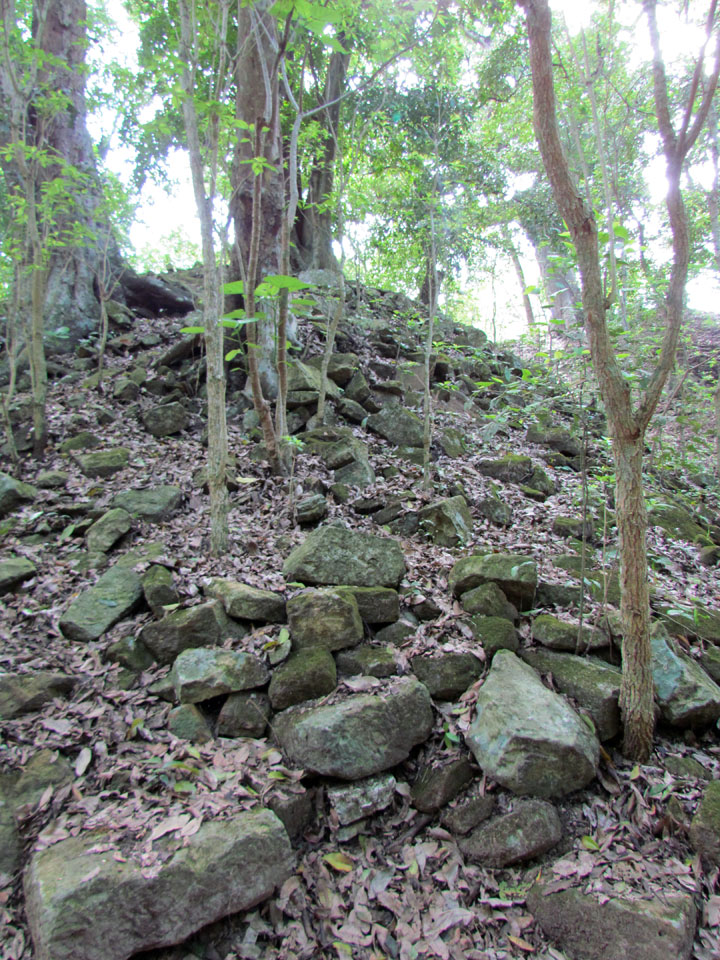
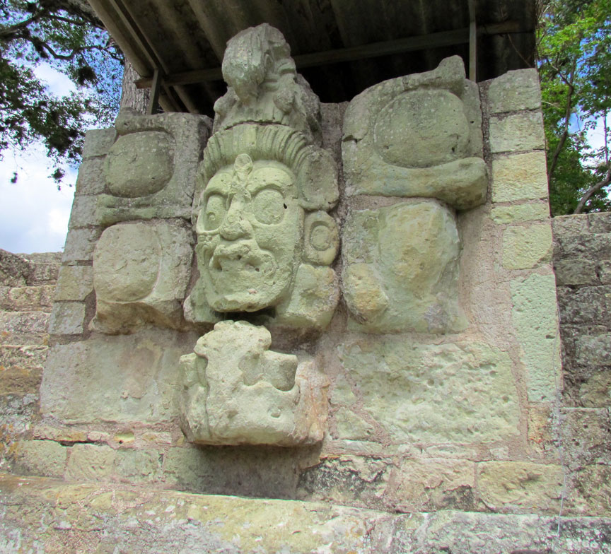
unexcavated
Ceramic lid shaped to represent K'inich Yax K'uk' Mo', recovered from the tomb of the 7th century king Smoke Imix, under Temple 26.
The city was refounded by K'inich Yax K'uk' Mo', establishing it as the capital
of a new Maya kingdom.[2] This coup was apparently organized and launched from
Tikal. Texts record the arrival of a warrior named K'uk' Mo' Ajaw who was
installed upon the throne of the city in AD 426 and given a new royal name,
K'inich Yax K'uk' Mo' and the ochk'in kaloomte "Lord of the West" title used a
generation earlier by Siyaj K'ak', a general from the great metropolis of
Teotihuacan who had decisively intervened in the politics of the central Petén.
K'inich Yax K'uk' Mo' was probably from Tikal and was likely to have been
sponsored by Siyaj Chan K'awill II, the 16th ruler in the dynastic succession of
Tikal. K'inich Yax K'uk' Mo' may have legitimized his claim to rulership by
marrying into the old Copán royal family, evidenced from the remains of his
presumed widow. Bone analysis of her remains indicates that she was local to
Copán. After the establishment of the new kingdom of Copán, the city remained
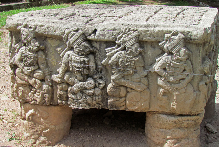
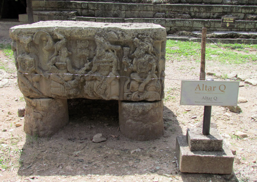
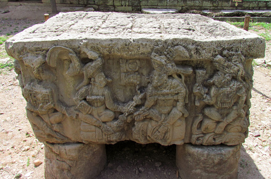
closely allied with Tikal. The hieroglyphic text on Copán Altar Q describes the
lord being elevated to kingship with the receipt of his royal scepter. The
ceremonies involved in the founding of the Copán dynasty also included the
installation of a subordinate king at Quiriguá.
A text from Tikal mentions K'uk' Mo' and has been dated to AD 406, twenty years
before K'uk' Mo' Ajaw founded the new dynasty at Copán. Both names are likely to
refer to the same individual originally from Tikal. Although none of the
hieroglyphic texts that mention the founding of the new Copán dynasty describe
how K'uk' Mo' arrived at the city, indirect evidence suggests that he conquered
the city by military means. On Altar Q he is depicted as a Teotihuacano warrior
with goggle eyes and a war serpent shield. When he arrived at Copán he initiated
the construction of various structures, including one temple in the
talud-tablero style typical of Teotihuacan and another with inset corners and
apron moldings that are characteristic of Tikal. These strong links with both
the Maya and Central Mexican cultures suggest that he was at least a Mexicanized
Maya or possibly even from Teotihuacan. The dynasty founded by king K'inich Yax
K'uk' Mo' ruled the city for four centuries and included sixteen kings plus a
probable pretender who would have been seventeenth in line. Several monuments
have survived that were dedicated by K'inich Yax K'uk' Mo' and by his heir.
K'inich Yax K'uk' Mo' died between AD 435 and AD 437. In 1995 a tomb underneath
the talud-tablero Hunal temple was discovered by a team of archaeologists led by
Robert Sharer and David Sedat. The tomb contained the skeleton of an elderly man
with rich offerings and evidence of battle wounds. The remains have been
identified as those of K'inich Yax K'uk' Mo' due to their location underneath a
sequence of seven buildings erected in his honor. Bone analysis has identified
the remains as being those of someone foreign to Copán itself.
K'inich Popol Hol inherited the throne of Copán from K'inich ax K'uk' Mo', who
was his father. He undertook major construction projects with the redesign of
the core of Copán. Popol Hol is not the original name of this king but rather a
nickname based on the appearance of his Teotihuacan-linked name glyph. K'inich
Popol Hol oversaw the construction of the first version of the Mesoamerican
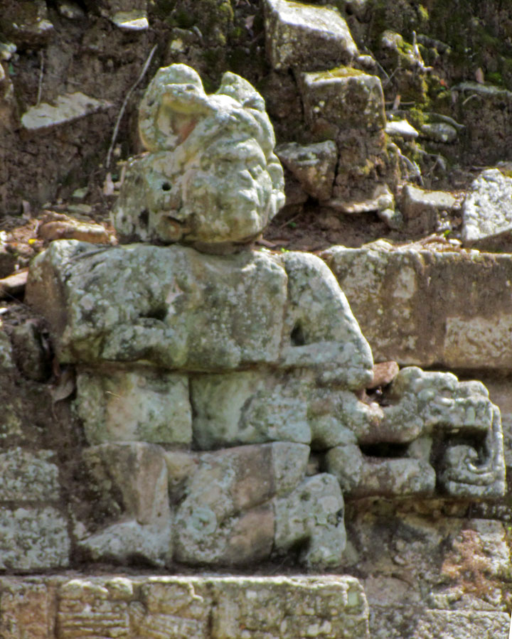
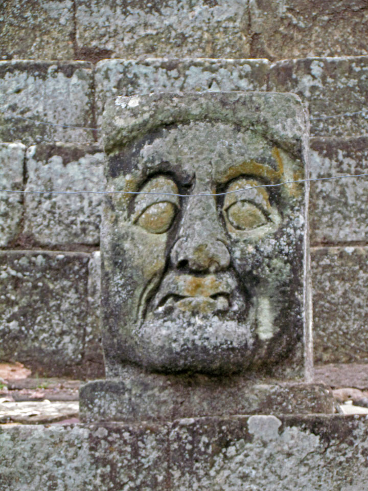
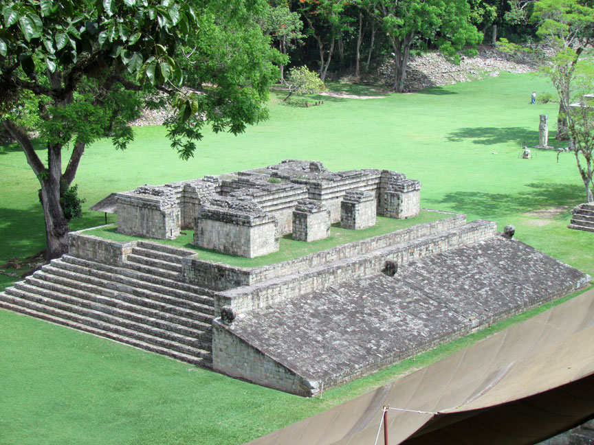
ballcourt at the city, which was decorated with images of the Scarlet Macaw, a
bird that features prominently in Maya mythology. His greatest construction
activity was in the area of his father's palace, now underlying Structure
10L-16, which he demolished after entombing his father there. He then built
three successive buildings on top of the tomb in rapid succession.
Very little is known about Rulers 3 to 6 in the dynastic succession, although it
is known from a fragment of a broken monument reused as construction fill in a
later building that one of them was a son of Popol Hol. Ruler 3 is depicted on
the 8th century Altar Q but his name glyph has broken away. Ku Ix was the 4th
ruler in the succession. He rebuilt temple 10L-26 in the Acropolis, erecting a
stela there and a hieroglyphic step at its base. Although this king is also
mentioned on a few other fragments of sculpture, no dates accompany his name.
The next two kings in the dynastic sequence are only known from their sculptures
on Altar Q.
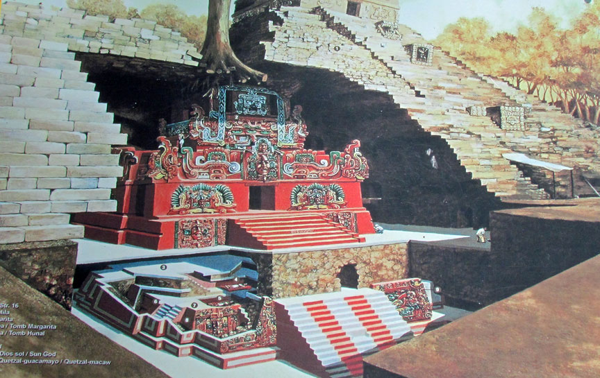
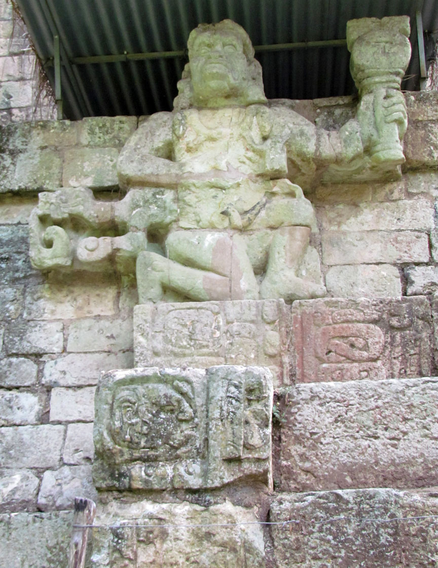
polychrome structures
B'alam Nehn (often referred to as Waterlily Jaguar) was the first king to actually record his position in the dynastic succession, declaring that he was seventh in line from K'inich Yax K'uk' Mo'. Stela 15 records that he was already ruling Copán by AD 504. B'alam Nehn is the only king of Copán to be mentioned in a hieroglyphic text from outside of the southeastern Maya region. His name appears in a text on Stela 16 from Caracol, a site in Belize. The stela dates to AD 534 but the text itself is not well understood. B'alam Nehn undertook major construction projects in the Acropolis, building over an early palace with a number of important structures.
Wil Ohl K'inich, the eighth ruler, is another king known only by his appearance
on Altar Q. He was succeeded by Ruler 9 in AD 551, his accession being described
on the Hieroglyphic Stairway. He is also depicted on Altar Q but ruled for a
very short period of less than two years.
The 10th ruler is nicknamed Moon Jaguar by Mayanists. He was a son of B'alam
Nehn, the 7th ruler. He was enthroned in May 553. His surviving monuments were
found in the modern village of Copán Ruinas, which was a major complex during
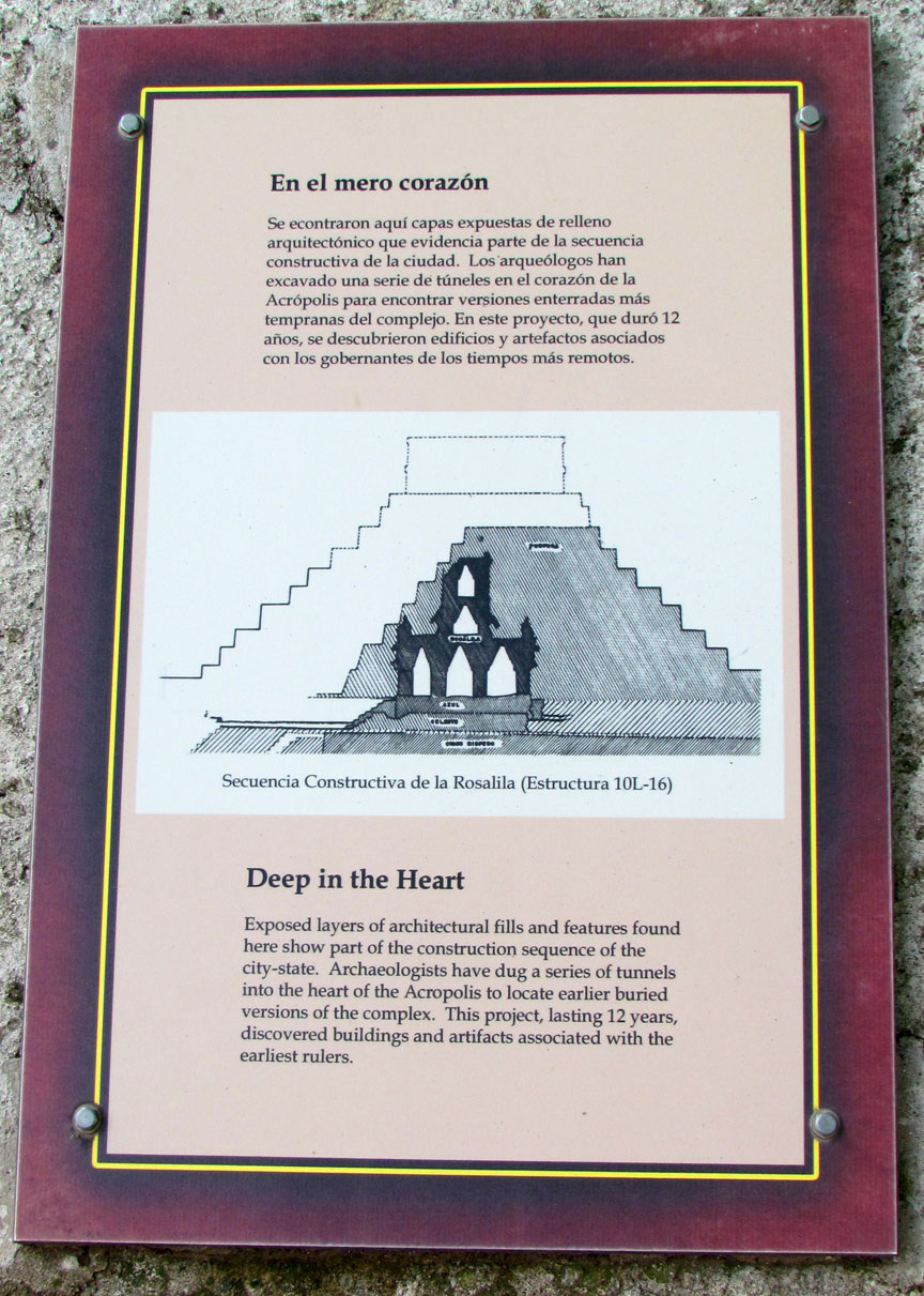
the Classic period. The most famous construction dating to his reign is the
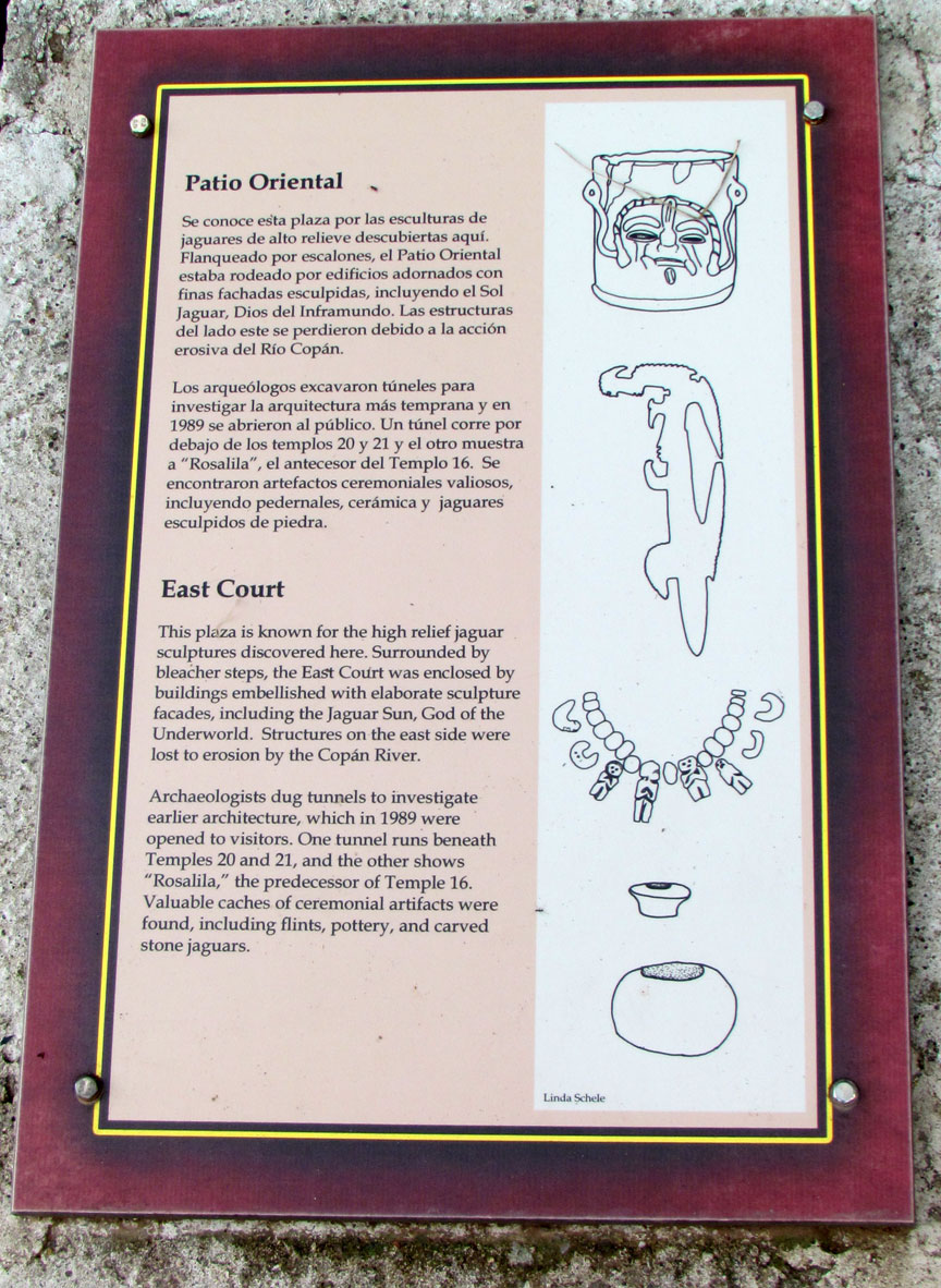
elaborate Rosalila phase of Temple 16, discovered entombed intact under later
phases of the temple during archaeological tunneling work.
K'ak' Chan Yopaat was the eleventh dynastic ruler at Copán. He was crowned as
king in AD 578, 24 days after the death of Moon Jaguar. At the time of his rule
Copán was undergoing an unprecedented rise in population, with residential land
use spreading to all available land in the entire Copán Valley. The two
surviving stelae of K'ak' Chan Yopaat contain long hard-to-decipher hieroglyphic
texts and are the oldest monuments at the site to survive without being either
broken or buried. He had a long reign, ruling at Copán for 49 years, and he died
on 5 February 628. His name is recorded on four stelae erected by his
successors, one of which describes a rite performed with relics from his tomb in
AD 730, almost a hundred years after his death.
Smoke Imix was crowned 16 days after the death of K'ak' Chan Yopaat. He is
thought to have been the longest reigning king of Copán, ruling from 628 to 695.
He is believed to have been born in AD 612 to have become king at the age of 15.
Archaeologists have recovered little evidence of activity for the first 26 years
of his reign but in AD 652 there was a sudden explosion of monument production,
with two stelae being erected in the Great Plaza and a further four in important
locations across the Copán Valley. These monuments all celebrated a katun-ending.
He also erected a stela at the Santa Rita site 12 kilometers (7.5 mi) away and
is mentioned on Altar L at Quiriguá in relation to the same event in 652. It is
thought that he was trying to stamp his authority throughout the whole valley
after the end of some earlier restriction to his freedom to rule as he wished.
After this sudden spate of activity, Smoke Imix continued to rule until almost
the end of the 7th century, he dedicated another 9 known monuments and made
important changes to the architecture of Copán, including the construction of
Structure 2 which closes the northern side of the Great Plaza and a new version
of Temple 26, nicknamed Chorcha. Smoke Imix ruled Copán for 67 years and died on
15 June 695 at the age of 79, an age that was so distinguished that it is used
to identify him in place of his name on Altar Q. His tomb had already been
prepared in the Chorcha phase of Temple 26 and he was buried just 2 days after
his death.
Uaxaclajuun Ub'aah K'awiil was crowned as the 13th king in the Copán dynasty in
July 695. He oversaw both the apogee of Copán's achievements and also one of the
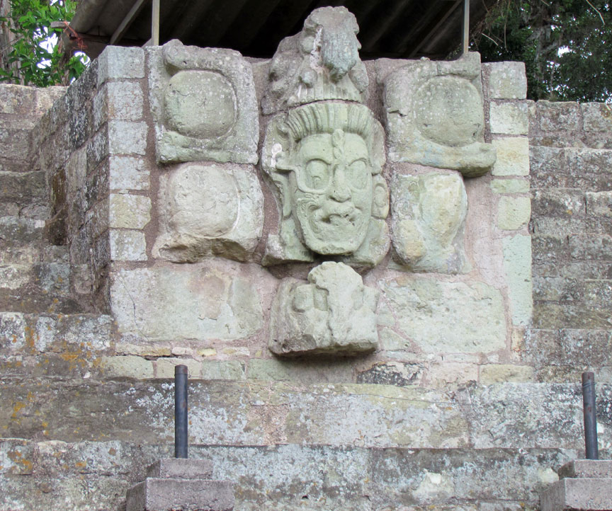
city's most catastrophic political disasters. During his reign, the sculptural
style of the city evolved into the full in-the-round sculpture characteristic of
Copán. In AD 718, Copán attacked and defeated the unidentified site of Xkuy,
recording its burning on an unusual stone cylinder. In AD 724 Uaxaclajuun Ub'aah
K'awiil installed K'ak' Tiliw Chan Yopaat as a vassal on the throne of Quiriguá.
Uaxaclajuun Ub'aah K'awiil was confident enough in his power to rank his city
among the four most powerful states in the Maya region, together with Tikal,
Calakmul and Palenque, as recorded on Stela A. In contrast to his predecessor,
Uaxaclajuun Ub'aah K'awiil concentrated his monuments in the site core of the
Copán; his first was Stela J, dated to AD 702 and erected at the eastern
entrance to the city.
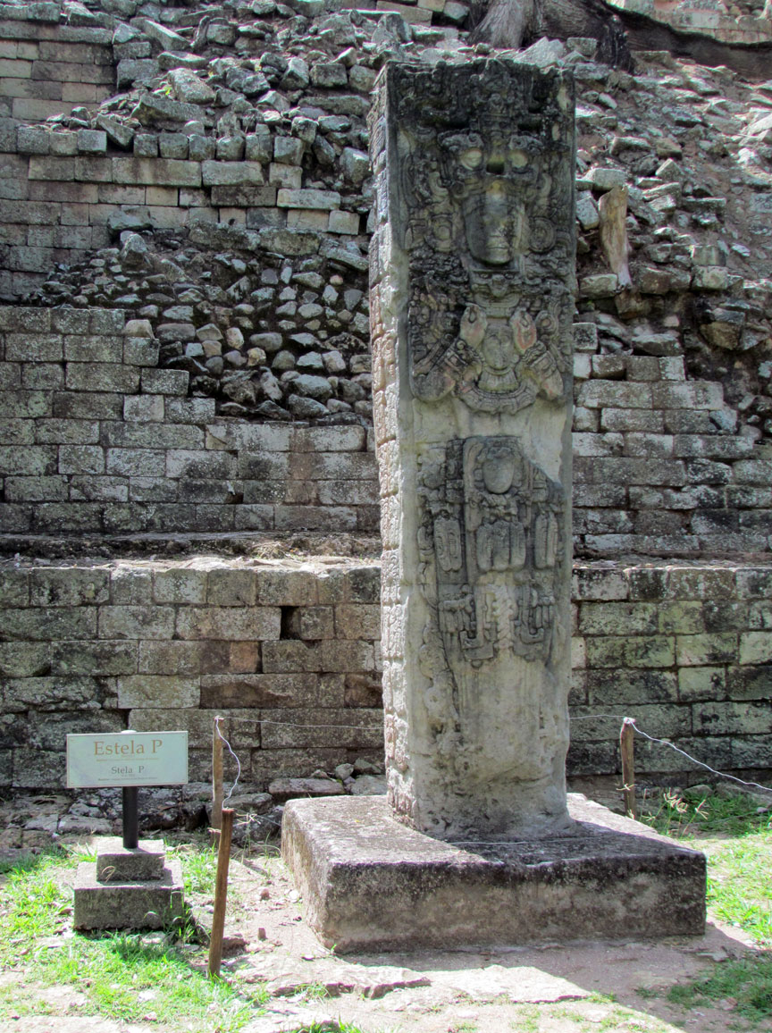
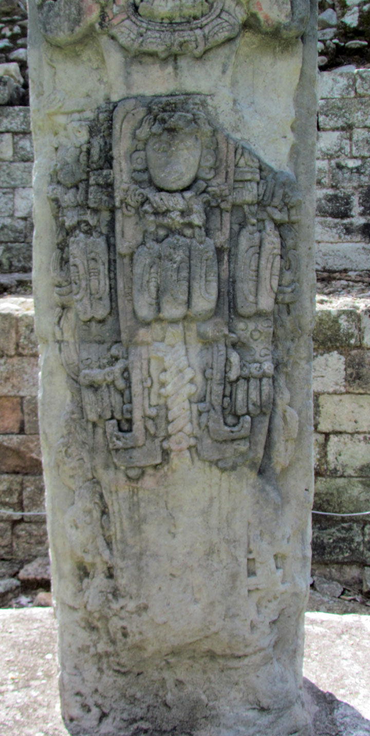
He continued to erect a further 7 high-quality stelae until AD 736, monuments
that are considered masterpieces of Classic Maya sculpture with such mastery of
detail that they represent the highest pinnacle of Maya artistic
achievement.[37] The stelae depict king Uaxaclajuun Ub'aah K'awiil ritually
posed and bearing the attributes of a variety of deities, including B'olon
K'awiil, K'uy Nik Ajaw and Mo' Witz Ajaw. The king also carried out major
construction works, including a new version of Temple 26 that now bore the first
version of the Hieroglyphic Stairway, plus two temples that have now been lost
to the erosion of the Copán River. He also encased the Rosalila phase of Temple
16 within a new phase of construction. He remodelled the ballcourt, then
demolished it and built a new one in its place.
tree root
Uaxaclajuun Ub'aah K'awiil had only recently dedicated the new ballcourt in AD 738 when a completely unexpected disaster befell the city. Twelve years earlier he had installed K'ak' Tiliw Chan Yopaat on the throne of Quiriguá as his vassal. By 734 the king of Quiriguá had shown he was no longer an obedient subordinate when he began to refer to himself as k'ul ajaw, "holy lord", rather than simply as a subordinate lord ajaw. K'ak' Tiliw Chan Yopaat appears to have taken advantage of wider political rivalries and allied himself with Calakmul, the sworn enemy of Tikal. Copán itself was firmly allied with Tikal and Calakmul used its alliance with Quiriguá to undermine Tikal's key ally in the south.
Although the exact details are unknown, in April 738 K'ak' Tiliw Chan Yopaat
captured Uaxaclajuun Ub'aah K'awiil and burned two of Copán's patron deities.
Six days later Uaxaclajuun Ub'aah K'awiil was decapitated in Quiriguá. This coup
does not seem to have physically affected either Copán or Quiriguá; there is no
evidence that either city was attacked at this time and the victor seems not to
have received any detectable tribute. All of this seems to imply that K'ak'
Tiliw Chan Yopaat managed to somehow ambush Uaxaclajuun Ub'aah K'awiil, rather
than to have defeated him in outright battle. It has been suggested that
Uaxaclajuun Ub'aah K'awiil was attempting to attack another site to secure
captives for sacrifice in order to dedicate the new ballcourt when he was
ambushed by K'ak' Tiliw Chan Yopaat and his Quiriguá warriors.
In the Late Classic, alliance with Calakmul was frequently associated with the
promise of military support. The fact that Copán, a much more powerful city than
Quiriguá, failed to retaliate against its former vassal implies that it feared
the military intervention of Calakmul. Calakmul itself was far enough away from
Quiriguá that K'ak' Tiliw Chan Yopaat was not afraid of falling directly under
its power as a full vassal state, even though it is likely that Calakmul sent
warriors to help in the defeat of Copán. The alliance instead seems to have been
one of mutual advantage: Calakmul managed to weaken a powerful ally of Tikal
while Quiriguá gained its independence. The disaster for Copán had long-lasting
consequences; major construction ceased and no new monuments were raised for the
next 17 years.
K'ak' Joplaj Chan K'awiil was installed as the 14th dynastic ruler of Copán on 7
June 738, 39 days after the execution of Uaxaclajuun Ub'aah K'awiil. Little is
known of his reign due to the lack of monuments raised after Quiriguá's surprise
victory. Copán's defeat had wider implications due to the fracturing of the
city's domain and the loss of the key Motagua River trade route to Quiriguá. The
fall in Copán's income and corresponding increase at Quiriguá is evident from
the massive commissioning of new monuments and architecture at the latter city
and Copán may even have been subject to its former vassal. K'ak' Joplaj Chan
K'awiil died in January 749.
The next ruler was K'ak' Yipyaj Chan K'awiil, a son of K'ak' Joplaj Chan K'awiil.
The early period of his rulership fell within Copán's hiatus but later on he
began a programme of renewal in an effort to recover from the city's earlier
disaster. He built a new version of Temple 26, with the Hieroglyphic Stairway
being reinstalled on the new stairway and doubled in length. Five life-size
statues of seated rulers were installed seated upon the stairway. K'ak' Yipyaj
Chan K'awiil died in the early 760s and is likely to have been interred in
Temple 11, although the tomb has not yet been excavated.
Yax Pasaj Chan Yopaat was the next ruler, 16th in the dynasty founded by K'inich
Yax K'uk' Mo', although he appears not to have been a direct descendent of his
predecessor. He took the throne in June 763 and may have been only 9 years old.
He produced no monumental stelae and instead dedicated hieroglyphic texts
incorporated into the city's architecture and smaller altars. Texts make an
obscure reference to his father but his mother was a noblewoman from distant
Palenque in Mexico. He built the platform of Temple 11 over the tomb of the
previous king in AD 769 and added a two-storey superstructure that was finished
in AD 773. Around AD 776, he completed the final version of Temple 16 over the
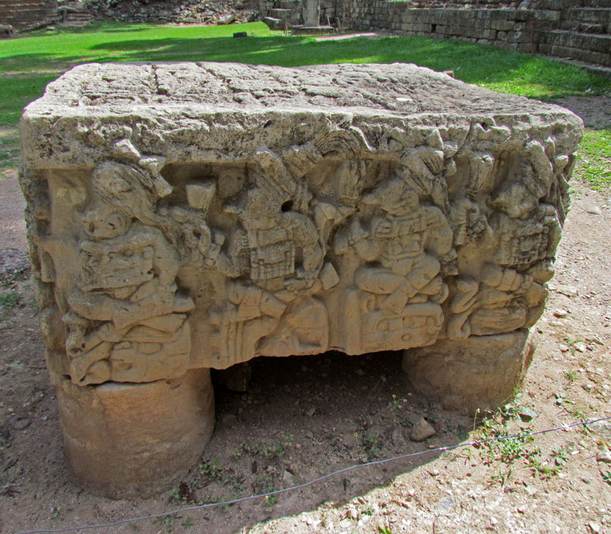
tomb of the founder. At the base of the temple, he placed the famous Altar Q,
which shows each of the 16 rulers of the city from K'inich Yax K'uk' Mo' through
to Yax Pasaj Chan Yopaat himself, with a hieroglyphic text on top describing the
founding of the dynasty. By the latter 8th century, the nobility had become more
powerful, raising palaces with hieroglyphic benches that were as richly
constructed as those of the king himself. At the same time, local satellites
were displaying their own local power, as demonstrated by the ruler of Los Higos
erecting his own stela in AD 781. Towards the end of Yax Pasaj Chan Yopaat's
reign, the city of Copán was struggling with overpopulation and a lack of local
resources, with a distinct fall in living standards among the populace. Yax
Pasaj Chan Yopaat was able to celebrate his second K'atun in AD 802 with his own
monument, but the king's participation in the K'atun ending ceremony of AD 810
was marked at Quiriguá, not at Copán itself. By this time the city's population
was over 20,000 and it had long needed to import basic necessities from outside.
The troubled times enveloping Copán at this time are evident from the funerary
tomb of Yax Pasaj Chan Yopaat, which bears sculptures of the king performing war
dances with spear and shield in hand. The sculpted column from the temple shrine
has a hieroglyphic text reading "toppling of the Foundation House" that may
refer to the fall of the Copán dynasty. Shortage and disease afflicted the
massively overpopulated valley of Copán when its last known king, Ukit Took',
came to the throne on 6 February 822. He commissioned Altar L in the style of
Altar Q but the monument was never finished — one face shows the enthronement of
the king and a second face was started but two others were completely blank. The
long line of kings at the once great city had come to an end. Before the end,
even the nobility had been struck by disease, perhaps because epidemics among
the malnourished masses spread to the elite. With the end of political authority
at the city the population collapsed to a fraction of what it had been at its
height. In the Postclassic period the valley was occupied by villagers who
robbed the stone from the monumental architecture of the city in order to build
their simple house platforms.
The first mention of Copán was in an early colonial period letter dated 8 March
1576. The letter was written by Diego García de Palacio, a member of the Royal
Audience of Guatemala, to king Philip II of Spain. French explorer Jean-Frédéric
Waldeck visited the site in the early 19th century and spent a month there
drawing the ruins. Colonel Juan Galindo lead an expedition to the ruins in 1834
on behalf of the government of Guatemala and wrote articles about the site for
English, French and North American publications. John Lloyd Stephens and
Frederick Catherwood visited Copán and included a description, map and detailed
drawings in Stephens' Incidents of Travel in Central America, Chiapas and
Yucatán, published in 1841. The site was later visited by British archaeologist
Alfred Maudslay. Several expeditions sponsored by the Peabody Museum of Harvard
University worked at Copán during the 20th century. The Carnegie Institution
also sponsored work at the site, in conjunction with the government of Honduras.
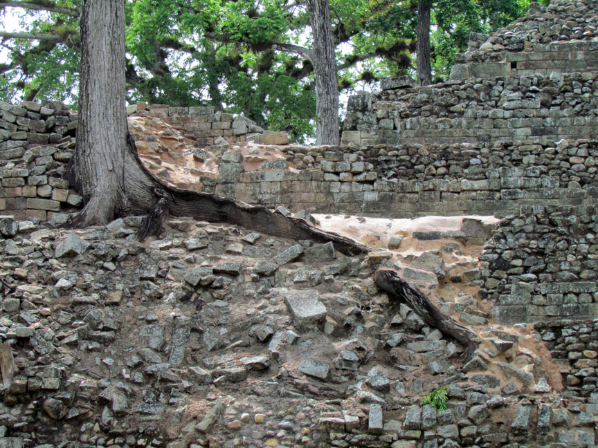
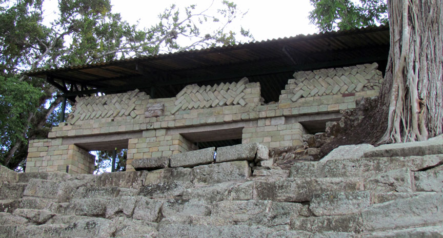
The Copán buildings suffered significantly from forces of nature in the
centuries between the site's abandonment and the rediscovery of the ruins. After
the abandonment of the city the Copán River gradually changed course, with a
meander destroying the eastern portion of the acropolis (revealing in the
process its archaeological stratigraphy in a large vertical cut) and apparently
washing away various subsidiary architectural groups, including at least one
courtyard and 10 buildings from Group 10L–2.[56] The cut is an important
archaeological feature at the site, with the natural erosion having created an
enormous cross-section of the acropolis. This erosion cut away a large portion
of the eastern part of the acropolis and revealed a vertical cross-section that
measures 37 meters (121 ft) high at its tallest point and 300 meters (980 ft)
long. The Carnegie Institution redirected the river to save the archaeological
site, although several buildings recorded in the 19th century had already been
destroyed, plus an unknown amount of the acropolis that was eroded before it
could be recorded. In order to avoid further destruction of the acropolis, the
Carnegie Institution diverted the river southwards in the 1930s; the dry former
riverbed was finally filled in at the same time as consolidation of the cut in
1990s. Structures 10L–19, 20, 20A and 21 were all destroyed by the Copán River
as it eroded the site away, but had been recorded by investigators in the 19th
century.
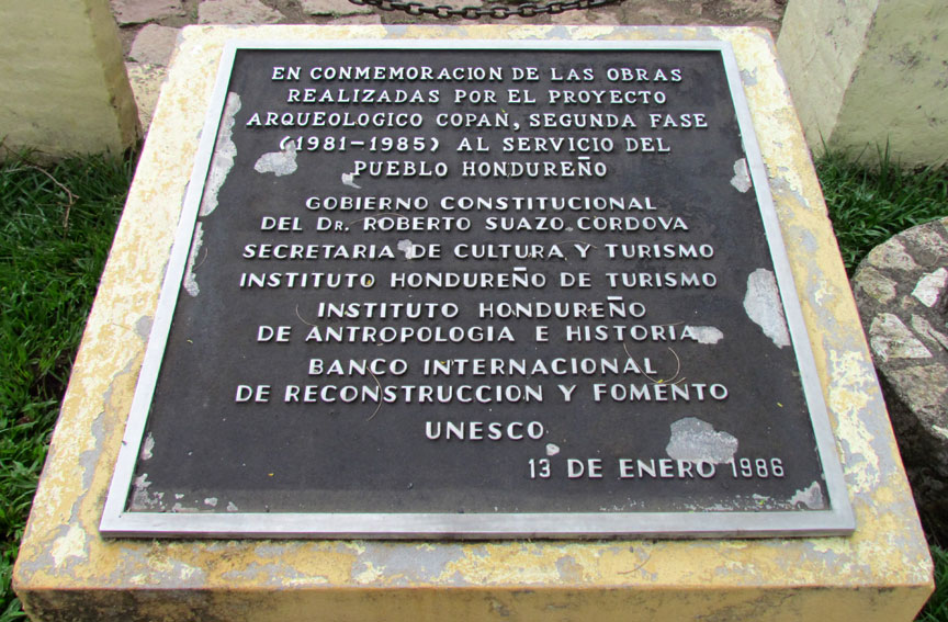
Copán was declared a UNESCO World Heritage Site in 1980, and UNESCO approved
funding of US$95,825 between 1982 and 1999 for various works at the site.
Looting remains a serious threat to Copán. A tomb was looted in 1998 as it was
being excavated by archaeologists.
Text from Wikipedia