


Azores


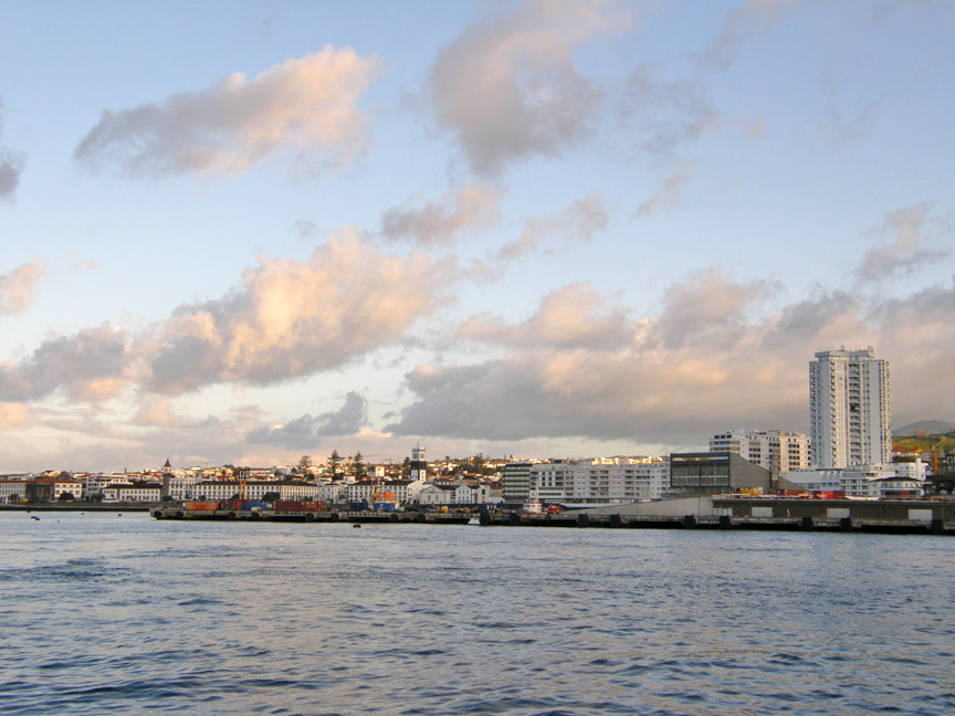
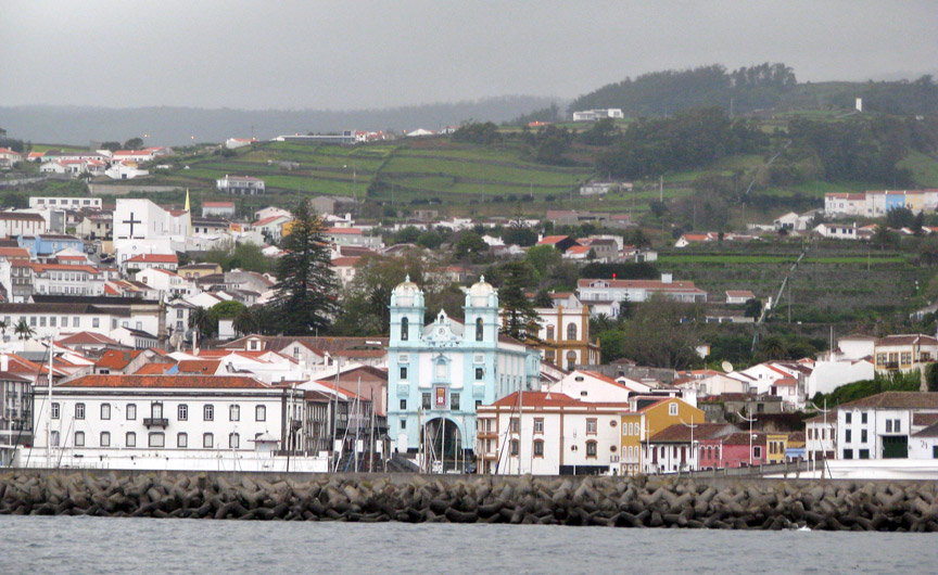
Ponta Delgada, the capital city of the Azores, on São Miguel Island.
The Azores is a Portuguese archipelago in the Atlantic Ocean, about 1,500 km (950 mi) from Lisbon and about 3,900 km (2,400 mi) from the east coast of North America. The two westernmost Azorean islands (Flores and Corvo) actually lie on the North American plate and are only 1,925 km (1,200 mi) from St. John's in the Canadian province of Newfoundland and Labrador. The Azores' most significant industries are tourism, cattle raising for milk and meat, and fishing.
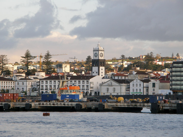
Ponta Delgada
More Photos of São Miguel Island
The nine major Azorean Islands and the eight small Formigas extend for more than 600 km (373 mi), and lie in a north west-south east direction. The vast extension of the islands defines an immense exclusive economic zone of 1.1 million km². The westernmost point of this area is 3,380 km (2,100 mi) from the North American continent. All of the islands have volcanic origins, though Santa Maria also has some reef contribution. The mountain of Pico on Pico Island, at 2,351 m (7,713 ft) in altitude, is the highest in all of Portugal. The Azores are actually the tops of some of the tallest mountains on the planet, as measured from their base at the bottom of the ocean. The archipelago forms the Autonomous Region of Azores, one of the two autonomous regions of Portugal.
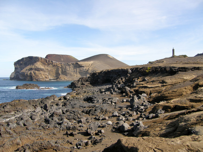
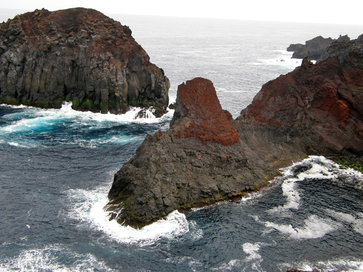
Capelinhos Vulcano, Faial Island,
Azores.
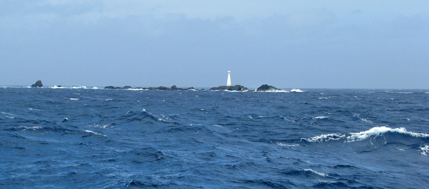
The lighthouse marks the old position of the Ponta dos Capelinhos.
Though it is commonly said that the archipelago is named after the goshawk (Açor
in Portuguese), because it was supposed to be a common bird at the time of the
discovery, the bird actually never existed on the islands. Some historians
indicate the archaic Portuguese word "azules" (the plural of blue) because of
the colour of the islands when seen from afar. Most, however, insist that the
name is derived from birds, pointing to a local subspecies of the buzzard (Buteo
buteo), as the animal the first explorers erroneously identified as goshawks.
The islands were known in the fourteenth century and can be seen incompletely,
for example, in the Atlas Catalan. In 1427, one of the captains sailing for
Henry the Navigator rediscovered the Azores, possibly Gonçalo Velho, but this is
not certain. The colonization of the then unoccupied islands started in 1439
with people mainly from the continental provinces of Algarve and Alentejo. In
1583, Philip II of Spain as king of Portugal, sent his fleet to clear the Azores
of a combined multinational force of adventurers, mercenaries, volunteers and
soldiers who were attempting to establish the Azores as a staging post for a
rival pretender to the Portuguese throne. Following the success of his fleet at
the Battle of Ponta Delgada, the captured enemy were hung from yardarms, as they
were considered pirates by Philip II (this was added to the "Black Legend" by
his enemies). The Azores were the second to last part of the Portuguese empire
to resist Philip's reign over Portugal (Macau being the last), Azores was
returned to Portuguese control with the end of the Iberian Union, not by the
professional military, which were used in the Restoration War in the mainland,
but by local people attacking a fortified Castilian garrison (guarnición).
Graciosa Island
More Photos from Graciosa Island
The 1820 civil war in Portugal had strong repercussions in the Azores. In 1829, in Vila da Praia, the liberals won over the absolutists, making Terceira Island the main headquarters of the new Portuguese regime and also where the Council of Regency (Conselho de Regência) of Mary II of Portugal was established.
Angra do Heroísmo, Terceira Island
More Photos of Terceira Island
Beginning in 1868, Portugal issued its stamps overprinted with "AÇORES" for use
in the islands. Between 1892 and 1906, it also issued separate stamps for the
three administrative districts of the time.
From 1836 to 1976, the archipelago was divided into three districts, quite
equivalent (except in area) to those in the Portuguese mainland. The division
was arbitrary, and didn't follow the natural island groups, rather reflecting
the location of each district capital on the three main cities (neither of each
on the western group).

Flores Island
* Angra consisted of Sao Miguel,Terceira, São Jorge, and Graciosa, with the
capital at Angra do Heroísmo on Terceira.
* Horta consisted of Pico, Faial, Flores, and Corvo, with the capital at Horta
on Faial.
* Ponta Delgada consisted of São Miguel and Santa Maria, with the capital at
Ponta Delgada on São Miguel.
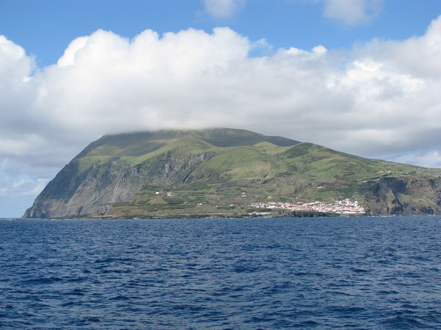
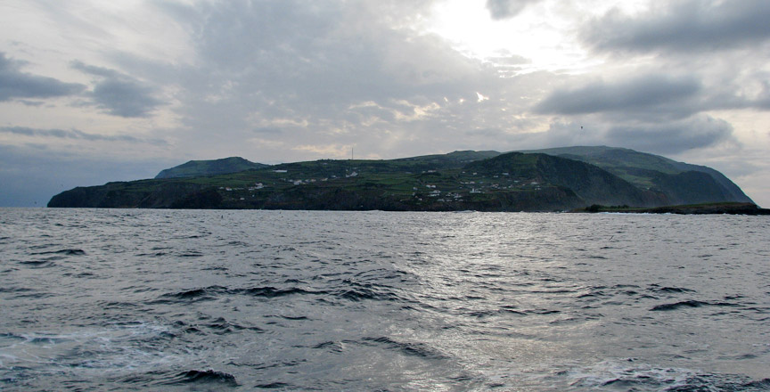
Ilha do Corvo
During the Second World War, in 1943, Portuguese dictator António de Oliveira Salazar leased bases in the Azores to the British. This represented a change in policy. Previously the Portuguese government only allowed German U-boats and navy ships to refuel there. This was a key turning point in the Battle of the Atlantic, allowing the Allies to provide aerial coverage in the middle of the Atlantic. This helped them to hunt U-boats and protect convoys.
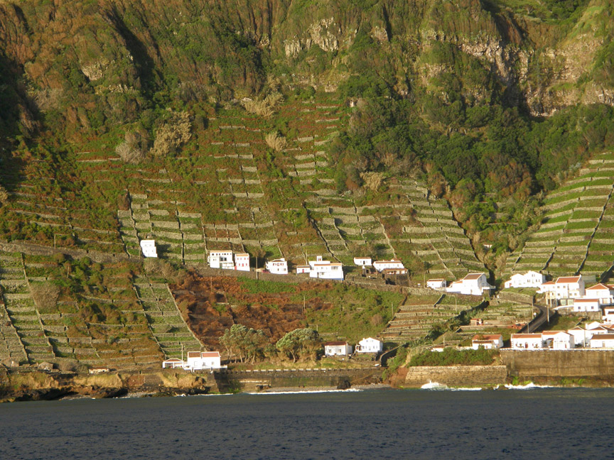
island of Santa Maria
In 1944, American forces constructed a small and short-lived air base on the island of Santa Maria. In 1945, a new base was founded on the island of Terceira and is currently known as Lajes Field. It was founded in an area called Lajes, a broad, flat sea terrace that had been a farm. Lajes Field is a plateau rising out of the sea on the north east corner of the island. This air force base is a joint American and Portuguese venture. Lajes Field continues to support US and Portuguese military operations. During the Cold War, the US Navy P-3 Orion anti-submarine squadrons patrolled the North Atlantic for Soviet submarines and surface spy vessels. Since its inception, Lajes Field has been used for refuelling aircraft bound for Europe, and more recently, the Middle East. The US Army operates a small fleet of military ships - probably Maritime Prepositioning Ships - in the harbour of Praia da Vitória, three kilometres (2 mi) south east of Lajes Field. The airfield also has a small commercial terminal handling scheduled and chartered passenger flights from other islands in the archipelago, Europe, and North America.
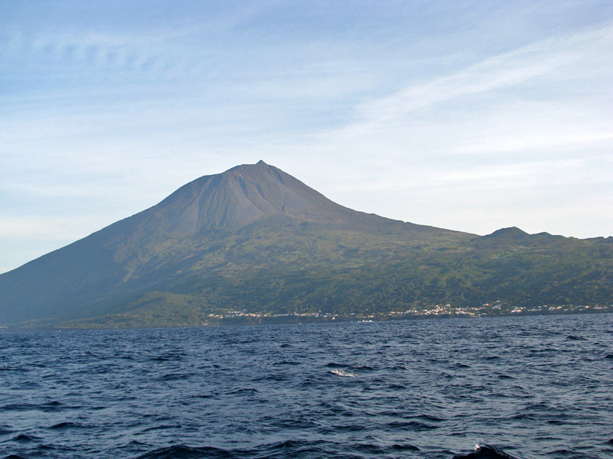
Ponta de Pico
In 1976, the Azores became the Autonomous Region of the Azores (Região Autónoma
dos Açores), one of the Autonomous regions of Portugal, and the Azorean
districts were suppressed.
São Jorge Island
More Photos of São Jorge Island
Formigas Isletsts
More Photos of the Formigas Islets
Azorean politics are dominated by the two largest Portuguese political parties—PSD and PS, the latter holding a majority in the Regional Legislative Assembly. The CDS/PP is also represented in the local parliament. Even though the PS dominates the administrative scene, the PSD is usually more popular in city and town council elections.
Text from Wikipedia
![]()
Return to Atlantic Islands page


![]()