


Franz Joseph Glacier
Franz Joseph Glacier
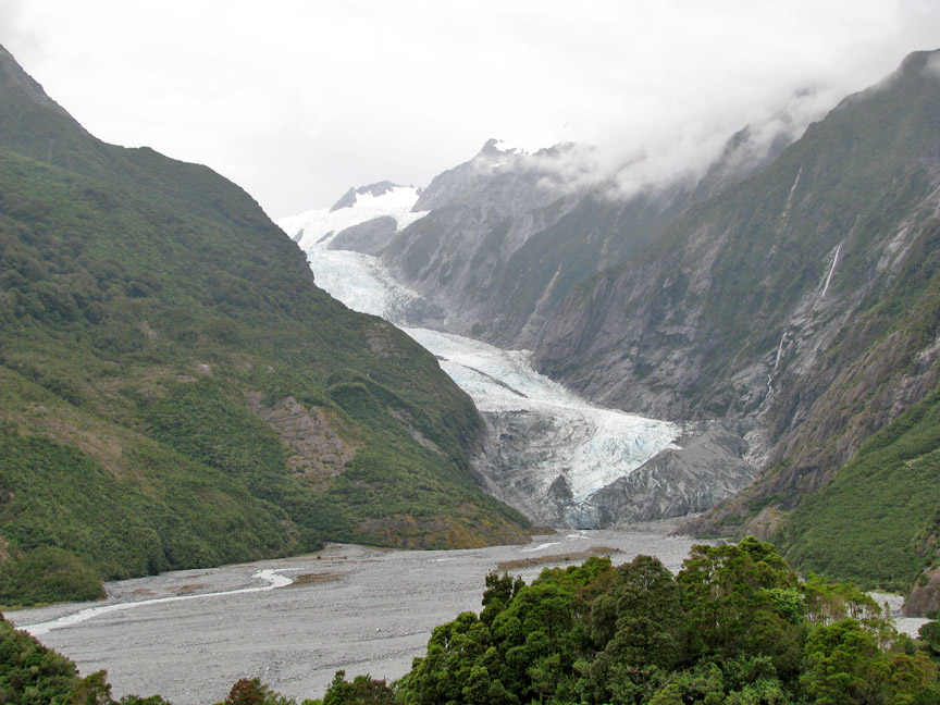
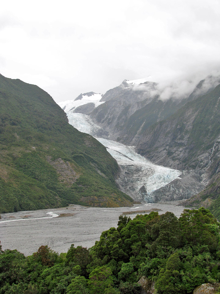
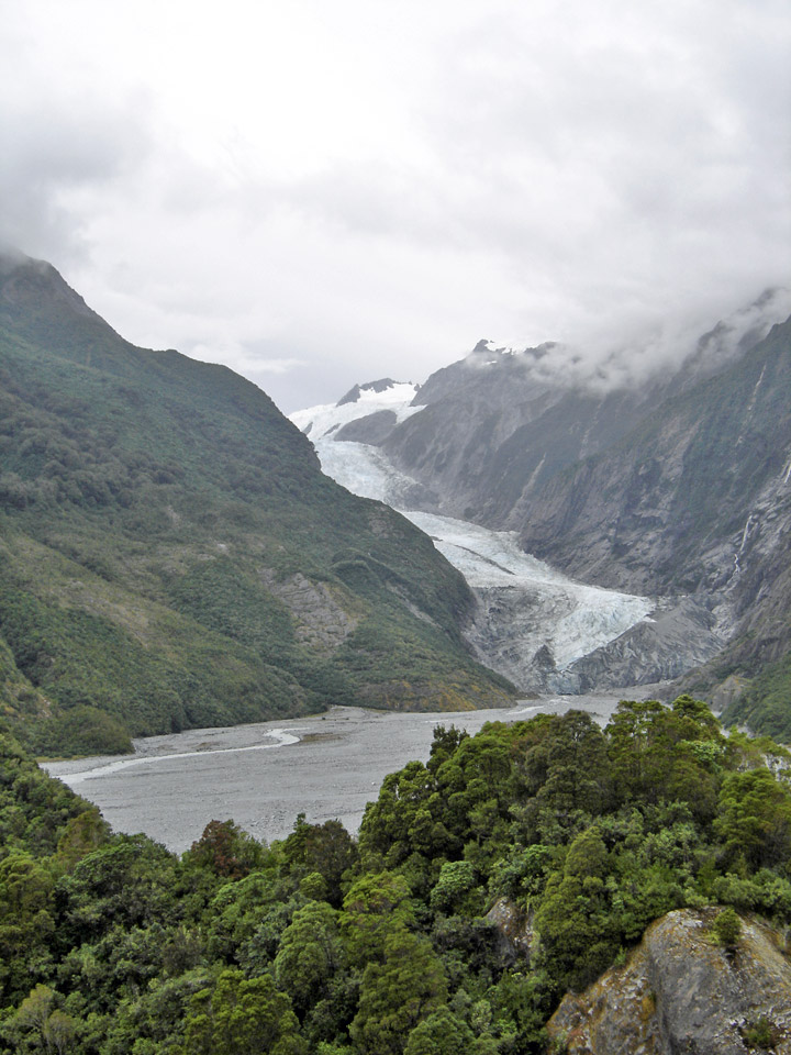
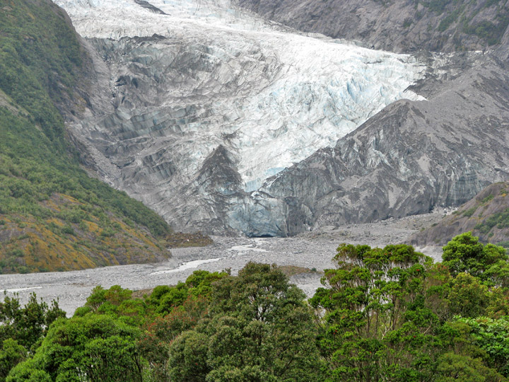
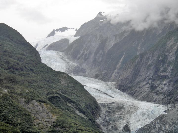
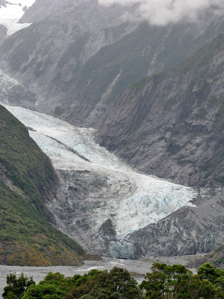
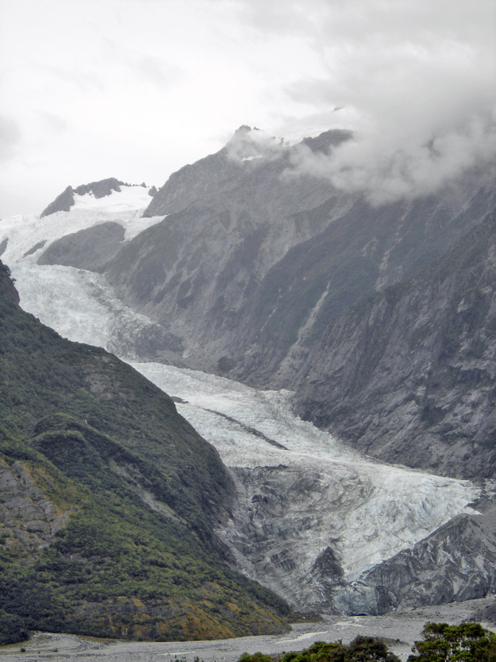
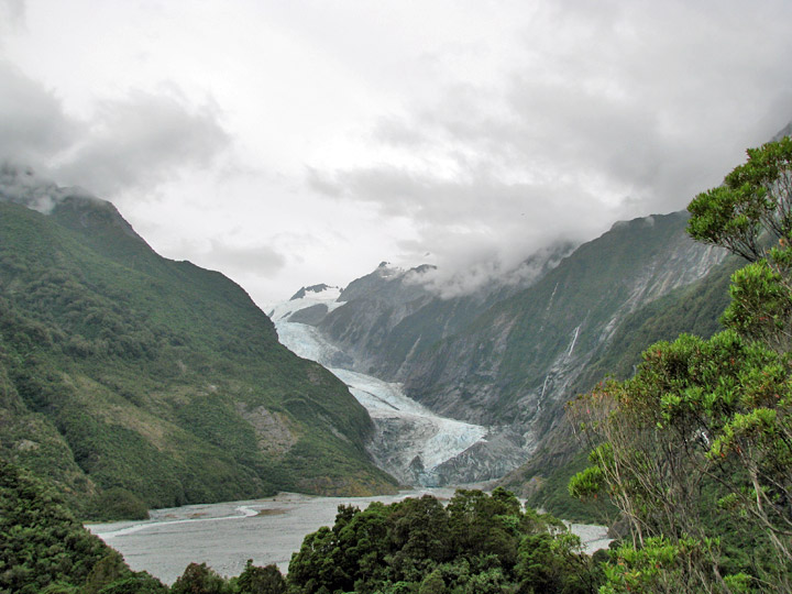
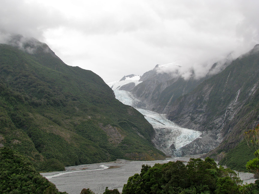
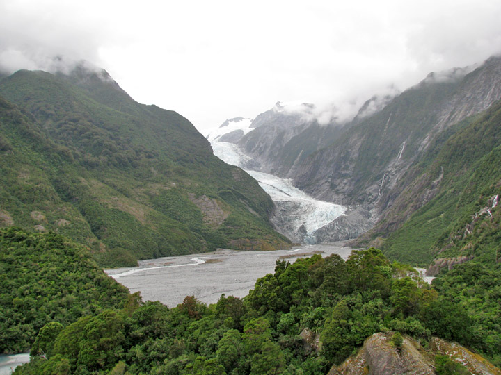
The Franz Josef (Ka Roimata o Hinehukatere in Māori) is a 12 km long glacier located in Westland National Park on the West Coast of New Zealand's South Island. Together with the Fox Glacier 20 km to the south, it is unique in the fact that it descends from the Southern Alps to less than 300 meters above sea level amidst the greenery and lushness of a temperate rainforest. It is also one of only three glaciers to come so close to a coastline.
The area surrounding the two glaciers is designated a World Heritage Site. The
river emerging from the glacier terminal of Franz Josef is known as the Waiho
River.
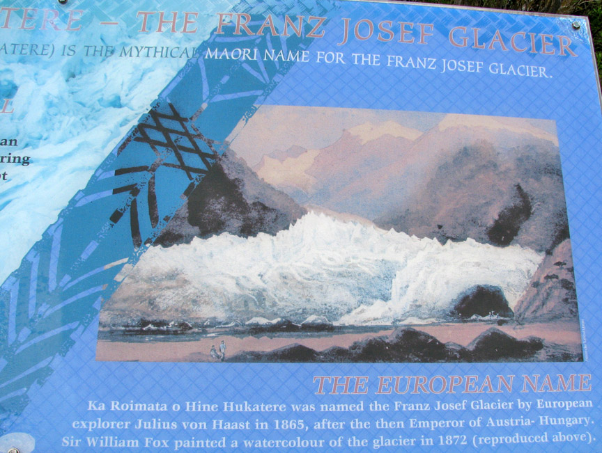
The first European mention of one of the western-coast glaciers, believed to be
Franz Josef, was from the steam ship Mary Louisa in 1859. The glacier was later
named after Emperor Franz Joseph I of Austria by the German explorer, Julius von
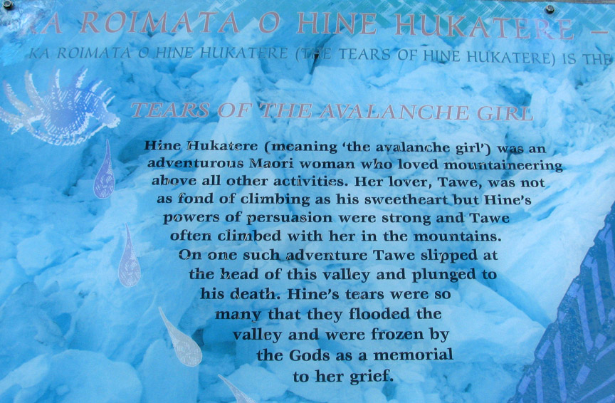
Haast in 1865. The Māori name for the glacier is Ka Roimata o Hinehukatere ('The
tears of Hinehukatere'), arising from a local legend: Hinehukatere loved
climbing in the mountains and persuaded her lover, Tawe, to climb with her. Tawe
was a less experienced climber than Hinehukatere but loved to accompany her
until an avalanche swept Tawe from the peaks to his death. Hinehukatere was
broken hearted and her many, many tears flowed down the mountain and froze to
form the glacier.
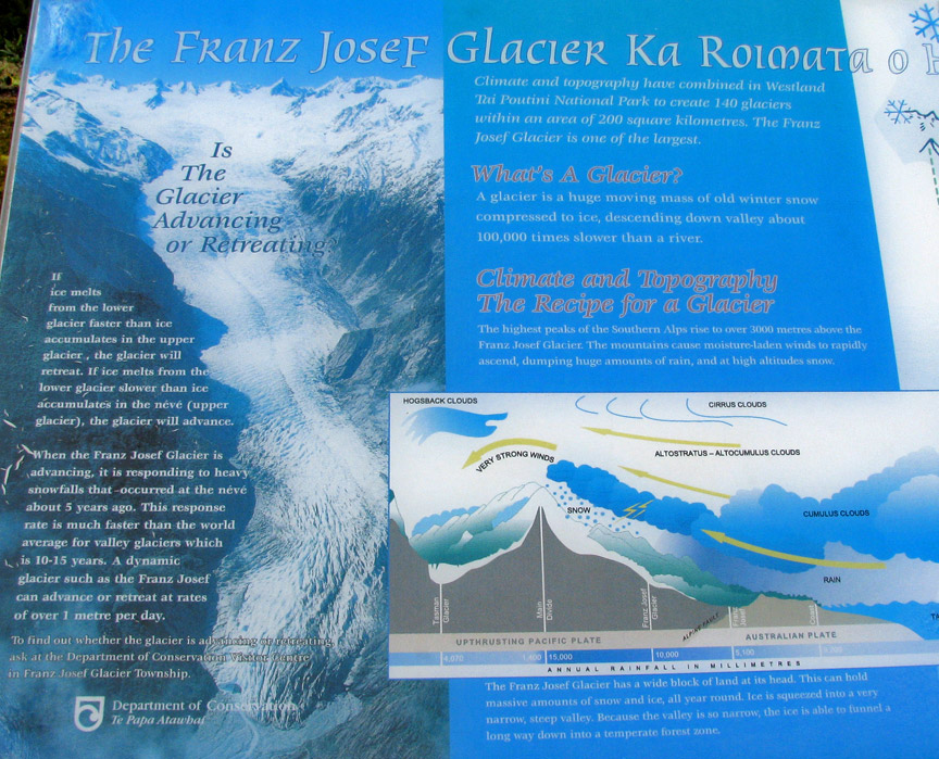
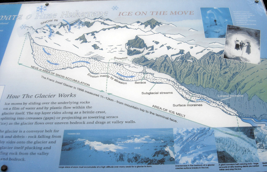
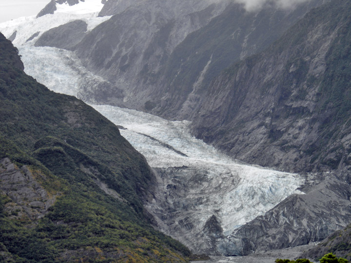
The glacier is currently 12 km long and terminates 19 km from the Tasman Sea.
Fed by a 20 sqm large snowfield at high altitude, it exhibits a cyclic pattern
of advance and retreat, driven by differences between the volume of melt water
at the foot of the glacier and volume of snowfall feeding the névé. Due to
strong snowfall it is one of the few glaciers in New Zealand which is still
growing as of 2007, while others, mostly on the eastern side of the Southern
Alps, have been shrinking heavily, a process attributed to global warming.
Having retreated several kilometers between the 1940s and 1980s, the glacier
entered an advancing phase in 1984 and at times has advanced at the phenomenal
(by glacial standards) rate of 70 cm a day. The flow rate is about 10 times that
of typical glaciers. Over the longer term, the glacier has retreated since the
last ice age, and it is believed that it extended into the sea some 10,000 to
15,000 years ago.
This cyclic behavior is well illustrated by a postage stamp issued in 1946,
depicting the view from St James Anglican Church. The church was built in 1931,
with a panoramic altar window to take advantage of its location. By 1954, the
glacier had disappeared from view from the church, but it reappeared in 1997.
This is due to the highly variable conditions on the snowfield, which take
around 5-6 years before they result in changes in the terminus location.
There have been some incidents of
jökulhlaups (outbreak floods from water-filled ice tunnels) at the glacier, with
one destroying a bridge on the access route in 1989.
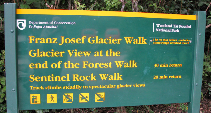
The glacier area is one of the main tourist attractions of the West Coast, with
around 250,000 visitors a year, and up to 2,700 per day (2007). Guided and
unguided walks up to and onto the glacier are possible. The latter require some
specialized equipment, namely ice axes and crampons that latch onto a sturdy
boot.
As the walking part of any tour up to the glacier takes a long time, and ends at
the first icefall (a sort of frozen waterfall, showing a natural dip of the land
underneath), numerous tourists book helicopter tours from one of the several
local airlines, which usually drop their guests between the first and second
icefall, for a guided 1-2 hour walk through the broken ground atop the glacier.
Though the glacial landscape changes almost daily with the glaciers unusually
fast flow, and some walks include passages through ice tunnels, they are still
considered quite safe and only somewhat strenuous.
My Photos of a Helicopter tour of the glacier
Franz Josef township is a little service village (approximately 270 inhabitants) located approximately 5 km away from the face of the glacier on State Highway 6. It has a small but busy heliport, numerous tourist accommodation options (with up to 2,000 people staying overnight during the main season) and a number of restaurants and shops.
Text from Wikipedia
Return to town of Franz Joseph