


Panama Canal Zone
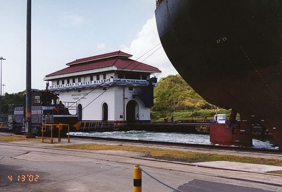
Miraflores lock
Panama Canal, canal across the Isthmus of Panama, in Central America, that allows vessels to travel between the Pacific and Atlantic oceans. The waterway measures 64 km (40 mi), including dredged approach channels at each end. The Panama Canal handles a large volume of world shipping and enables vessels to avoid traveling around South America, reducing their voyages by thousands of miles and many days.
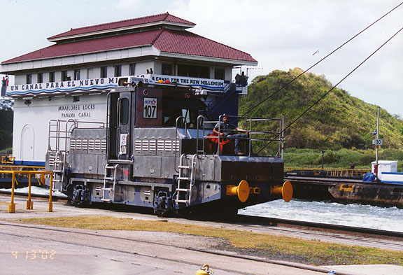
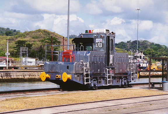
the mule
The canal consists of artificially created lakes, channels, and a series of locks, or water-filled chambers, that raise and lower ships through the mountainous terrain of central Panama. Built by the United States from 1904 to 1914, the Panama Canal posed major engineering challenges, such as damming a major river and digging a channel through a mountain ridge. It was the largest and most complex project of this kind ever undertaken at that time, employing tens of thousands of workers and costing $350 million.
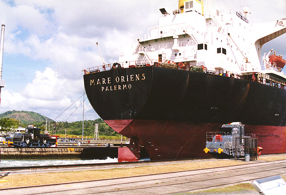
ship leaving the lock
(heading North to the Atlantic Ocean)
The canal cuts through the central and most populated region of Panama, and it has been a point of dispute between the governments of Panama and the United States through most of its existence. Under a 1903 treaty, the United States controlled both the waterway and a large section of the surrounding land, known as the Panama Canal Zone, as if they were U.S. territory. Panamanians resented this arrangement and argued that their country was unfairly denied benefits from the canal. Eventually, riots and international pressure led the United States to negotiate two new treaties, which were signed in 1977 and took effect in 1979. The treaties recognized Panama’s ultimate ownership of the canal and all the surrounding lands. More than half of the former Canal Zone came under Panamanian control shortly after the treaties were ratified. Control of the canal was turned over to Panama on December 31, 1999.
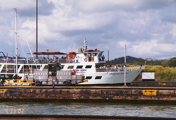
the day excursion boat going through the lock
The canal consists of dredged approaches and three sets of sets of locks at each end; Gatún Lake, one of the largest artificially created bodies of water in the world; and the excavated portion of the crossing, called Gaillard Cut. At Gatún, on the Atlantic side, the locks form continuous steps; on the Pacific side, a small lake (Miraflores) separates the middle and upper locks.
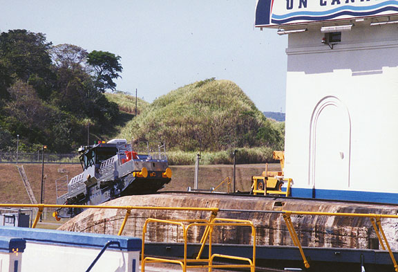
the new mule (from Mitsubishi)
Because the Isthmus of Panama extends east-west, a ship sailing from the Atlantic to the Pacific through the canal actually travels from northwest to southeast. To travel from the Atlantic to the Pacific, a ship enters Limón Bay from the north and anchors behind a breakwater to await scheduling of its passage. When ready, the canal authorities send out a canal pilot to take the vessel through the locks. The canal employs about 240 highly trained and experienced pilots to handle the complex job of steering ships through the waterway. As soon as the pilot takes over, the ship is under canal jurisdiction. Very large or hard-to-maneuver ships may require two or more pilots and assistance from tugboats.
mule returning to lower section of the lock
The ship travels south-southeast about 11 km (7 mi) and enters the first lock at Gatún. Line handlers at the lock attach steel mooring cables that are controlled by powerful electric locomotives, called mules. The mules guide the ship through the locks and steady it while the chambers are filled with water. In three steps the ship is raised to the level of Gatún Lake, 26 m (85 ft) above the sea.
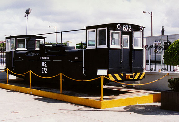
one of the original mules
The canal’s 12 locks (3 sets of double locks at each end) have the same dimensions: 33.5 m (110 ft) wide by 305 m (1,000 ft) long. The gates at each end are 2.1 m (7 ft) thick. Water enters and leaves each lock through a system of main culverts or pipes, which connect to 100 holes in the floor of each chamber. For each ship traveling through the canal, 197 million liters (52 million gallons) of fresh water are used, fed by gravity flow from Gatún Lake. To conserve water, smaller ships often go through the locks together.
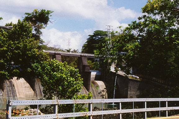
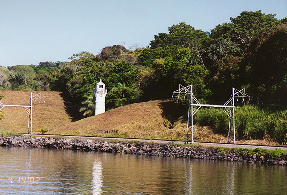
dam to maintain the water level in Lake Miraflores
At the top of the Gatún locks, the ship drops the mooring lines and proceeds under its own power for 37 km (23 mi) through the lake, following the former channel of the Chagres River. Gatún Dam, built adjoining the locks, flooded the river basin and formed the lake, which covers 430 sq km (166 sq mi). The flooding created a number of islands, as the water covered all but the tops of hills. One of these islands, Barro Colorado, is a wildlife refuge operated by the Smithsonian Tropical Research Institute.
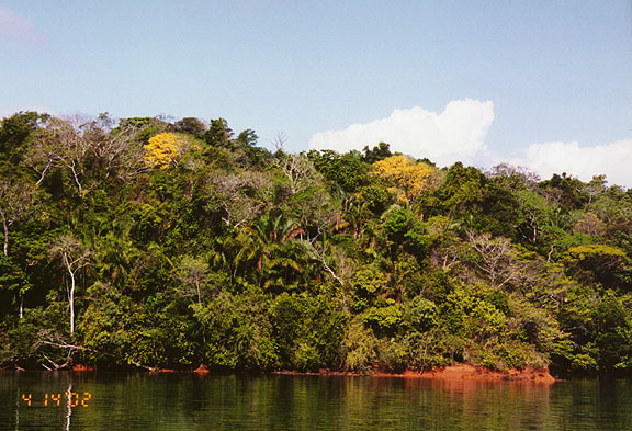
tropical growth along the canal
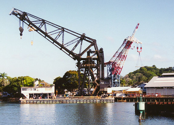
large crane
The waterway gradually narrows until the river turns to the east at Gamboa, flowing under a bridge of the Panama Railroad. The canal’s marine division, with cranes, dredges, tugs, and barges, is located at Gamboa.
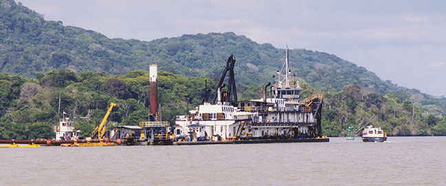
dredge to maintain proper water levels in the canal
South from Gamboa, the canal follows a channel dug through the mountains, which was the most difficult part of the construction project. Called Gaillard Cut, this section measures 14 km (9 mi) and traverses the Continental Divide, a ridge made of rock and shale. Numerous landslides occurred both during and after construction, requiring frequent dredging to keep the canal open. The channel through the cut is 150 m (500 ft) wide, the narrowest part of the canal. Originally only 91.5 m (300 ft), the cut was widened in phases beginning in the 1930s to allow two-way traffic. In the 1990s it was enlarged even more to accommodate larger ships.
railroad along the canal
More Photos of transit through the canal
At the southern end of Gaillard Cut, the ship slows and enters Pedro Miguel locks. Again, cables and mules guide and steady the ship before it is lowered 9.4 m (31 ft) to Miraflores Lake. The cables are released and the ship crosses the lake, which is 2.1 km (1.3 mi) long and lies 16 m (54 ft) above sea level. The ship then enters the last two locks, also named Miraflores, and is lowered to the level of the Pacific Ocean. The final stretch of the canal carries the ship to the harbor of Balboa, where the canal pilot leaves the vessel. The ship sails under the Bridge of the Americas (formerly known as the Thatcher Ferry Bridge) and into the Bay of Panama, an arm of the Pacific Ocean. Northbound ships anchor in the Bay of Panama while waiting for their turn to travel through the canal to the Atlantic.
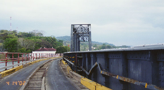
railroad and cars use the same bridge
The entire trip through the canal takes between 8 and 10 hours plus waiting time. The canal operates 24 hours a day year-round. Each ship that travels through the canal pays a toll based on its capacity.
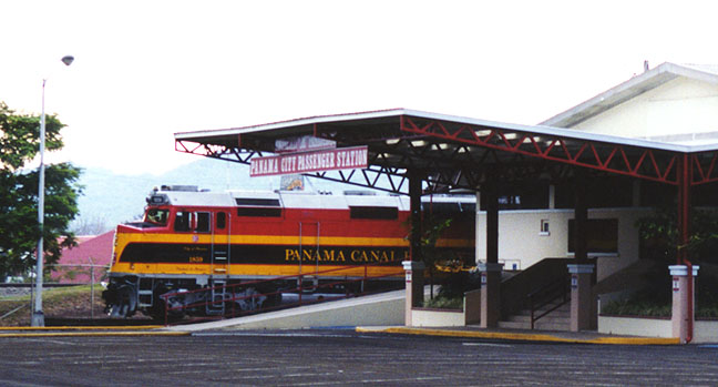
passenger rail station
More Photos of the Panama Canal Railroad
A large volume of the world’s ships, cargo, and passengers travel through the canal every year. In 1996 more than 15,000 ships, about 42 per day, made the crossing. From 1985 to 1995 the number of ships, their tonnage, and the amount of tolls collected all increased. Tolls rose to $460 million in 1995, a 50 percent increase over 1985 figures. About 14,000 ships, 400,000 crew members, and 300,000 passengers traveled through the canal in 1995.
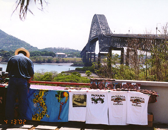
Bridge of the Americas
(spanning the canal)
More Photos of the Bridge of the Americas
A wide variety of general cargo vessels and specialized ships pass through the canal. The most common are bulk carriers for ore, grain, and liquids; automobile carriers; container ships; refrigerated ships; tankers; liquid-gas carriers; and passenger liners. Many naval vessels, fishing boats, barges, dredges, floating dry docks, and ocean-going tugs also use the canal.
sign of transfer of power
The principal commodities shipped through the canal in 1993 were canned and refrigerated foods, chemicals, coal and coke, grains, lumber and wood products, machinery and equipment (including automobiles), iron and steel products, minerals, ores and metals, agricultural commodities, and petroleum and by-products. The single largest commodity was grain, mostly being shipped from the U.S. Gulf Coast region to Asia. Another important group was automobiles: About half of the cars shipped from Asia to the United States went through the canal in the mid-1990s.
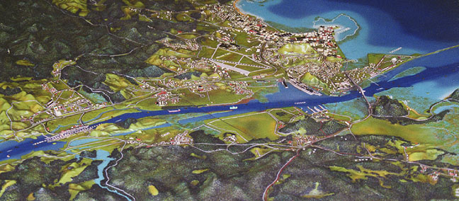
model of Southern end of the canal
(Miraflores locks to the Pacific Ocean)
The size of ships using the Panama Canal has steadily increased. About 27 percent of the vessels that use the canal are built to the maximum dimensions that can pass through it (a category called "Panamax"). This has prompted further widening of Gaillard Cut, so that the larger Panamax vessels may transit safely. However, some of the world’s commercial and military ships are too large for the canal. Since the 1940s, new U.S. battleships and aircraft carriers have been built exceeding the canal’s dimensions; so have some petroleum supertankers, huge container ships, and ore carriers. Despite this trend, planners anticipate steadily increasing demand for use of the canal for the next 20 years.
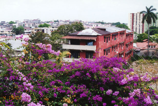
from the former Canal Zone, looking over Panama city
The Panama Canal was built in part for military reasons, to give the U.S. Navy rapid access to both the Atlantic and Pacific oceans. Many U.S. Army, Navy, and Air Force bases were built in the canal zone to defend the vital channel. However, since World War II (1939-1945) the canal has been considered vulnerable to attack. A single bomb or a scuttled ship could disrupt canal traffic for a long period, and the jungles along the canal could be used by guerrilla forces. Therefore, the canal was considered less valuable as a military asset. The nearby bases, while continuing to guard the canal, became a center for U.S. military operations throughout Central America and the Caribbean. The headquarters for the U.S. military’s Southern Command was relocated from bases in Panama to Florida in 1997. All U.S. military bases in Panama were closed before the end of 1999.
Text from Microsoft Encarta
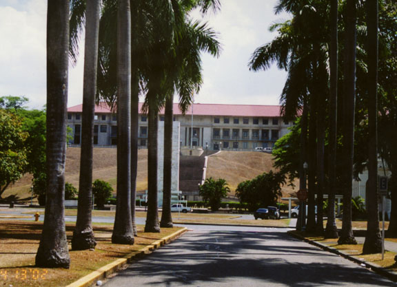
More Photos of the Panama Canal Administration Building
![]()


Return to Central America page


![]()