


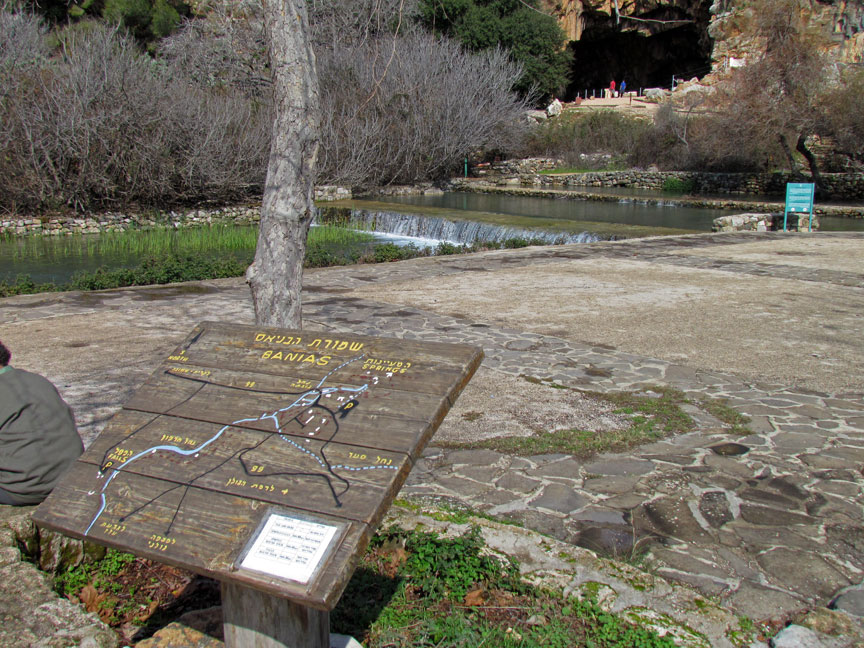
Banias
Banias (or Paneas; Greek: Πανειάς; Arabic: بانياس الحولة; Hebrew: בניאס) is an archaeological site by the uninhabited former city of Caesarea Philippi, located at the foot of Mount Hermon (Ba'al-Hermon, Arabic: جبل الشيخ, Jabal esh-Shaiykh, Hebrew: הר חרמון, Har Hermon) in the Golan Heights. The site is 150km north of Jerusalem and 60km southwest of Damascus. The city was located within the region known as the "Panion" (the region of the Greek god Pan), and is named after the deity associated with the grotto and shrines close to the spring called "Paneas".
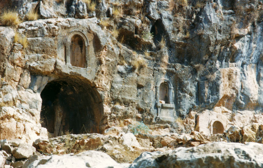
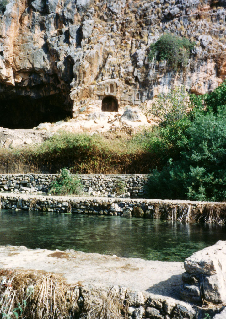
The temenos (sacred precinct) included a temple, courtyards, a grotto and niches
for rituals, and was dedicated to Pan. It was constructed on an elevated, 80m
long natural terrace along the cliff which towered over the north of the city. A
four-line inscription at the base of one of the niches relates to Pan and Echo,
the mountain nymph, and was dated to 87 CE.
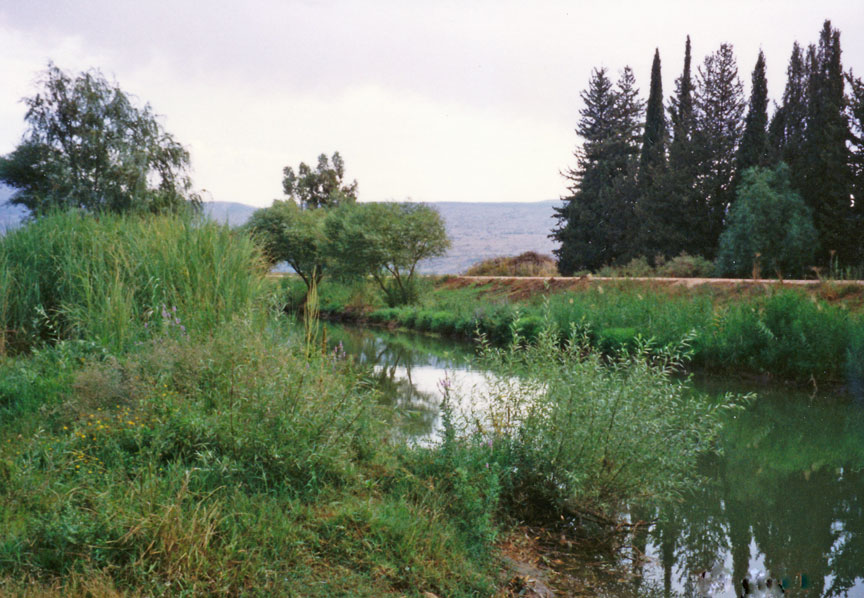
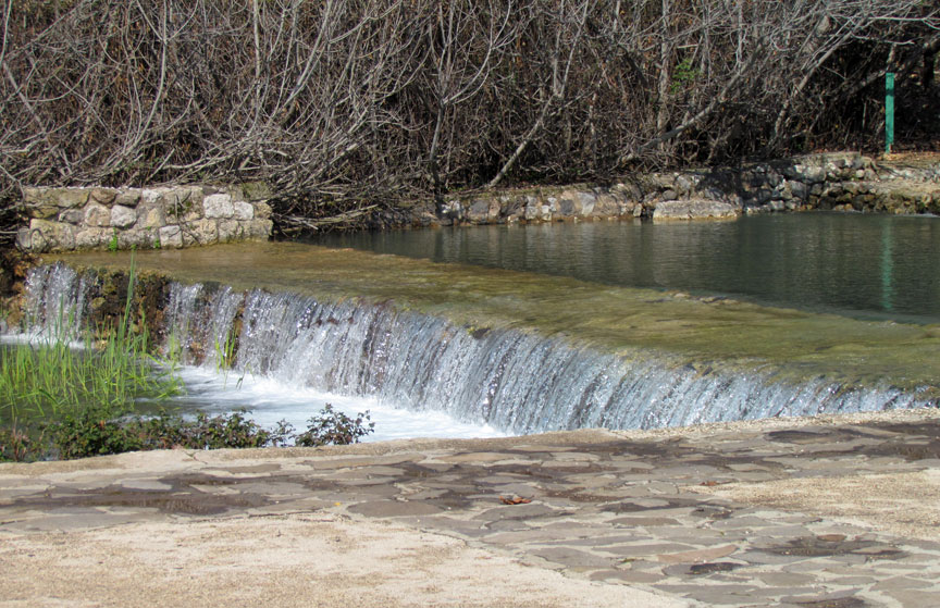
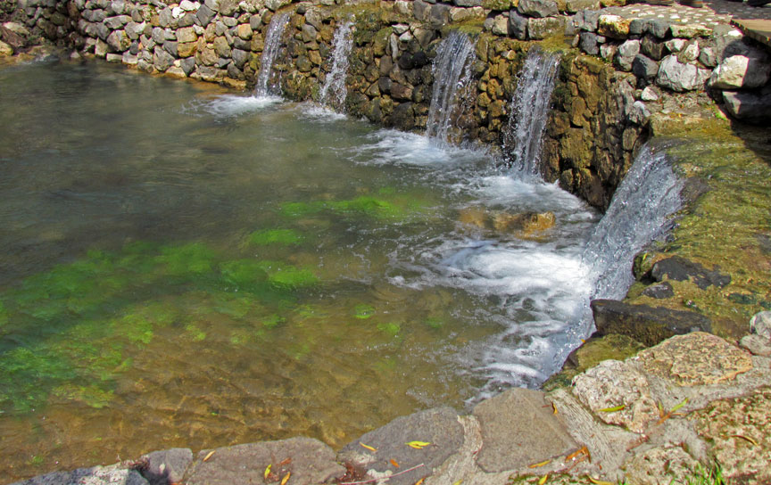
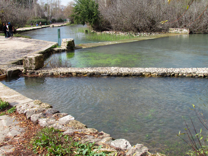
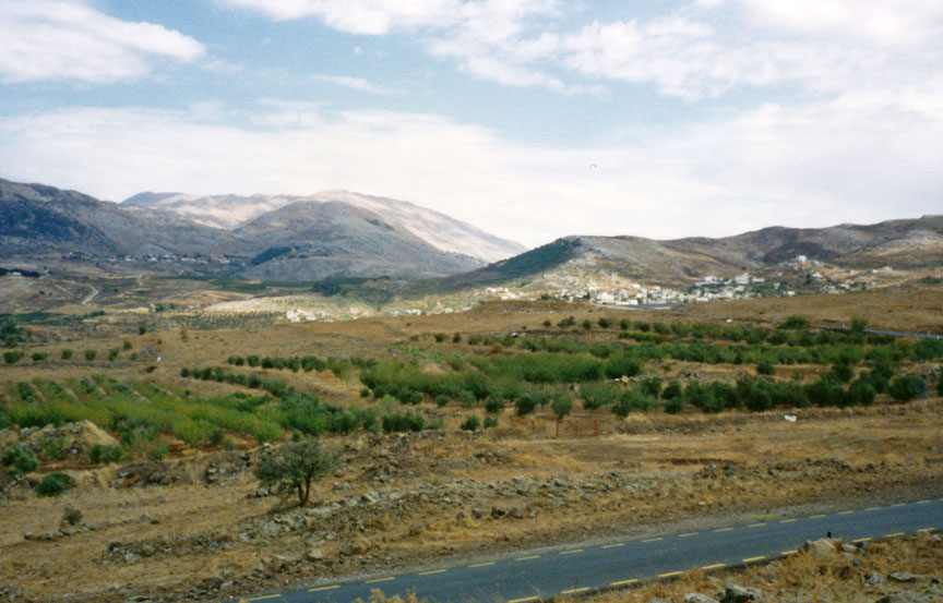
In the distant past, a giant spring gushed from a cave set in the limestone
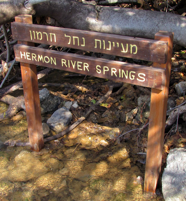
bedrock, to tumble down the valley and flow into the Hula marshes. Currently it
is the source of the Nahal Hermon stream. Whereas the Jordan River previously
rose from the malaria-infested Hula marshes, it now rises from this spring and
two others at the base of Mount Hermon. The flow of the spring has decreased
greatly in modern times. The water no longer gushes forth from the cave, but
only seeps from the bedrock below it.
The major Hellenistic realms; the Ptolemaic kingdom (dark blue); the Seleucid
empire (yellow); Macedon (green) and Epirus (pink). The orange areas were often
in dispute after 281 BC.
Alexander the Great's conquests started a process of Hellenisation in Egypt and
Syria that continued for some 1,000 years. Paneas was first settled in the
Hellenistic period. The Ptolemaic kings, in the 3rd century BC, built a cult
center there.
Panias is a spring, known also known Fanium, named for the Arcadian Pan, the
Greek god, a goat-footed god of victory in battle [creator of panic in the
enemy], isolated rural areas, music, goat herds, hunting, herding, and of sexual
and spiritual possession. It lies close to the fabled 'way of the sea' mentioned
by Isaiah. along which many armies of Antiquity marched. Paneas was certainly
an ancient place of great sanctity, and when Hellenised religious influences
began to overlay the region, the cult of its local numen gave place to the
worship of Pan, to whom the cave was therefore dedicated. The pre-Hellenic deity
associated with the site was variously called Ba'al-gad or Ba'al-hermon.
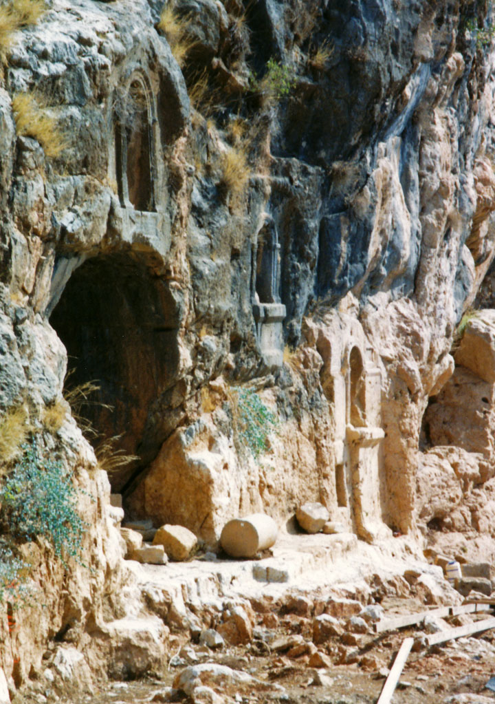
Pan cave
In extant sections of the Greek
historian Polybius's history of 'The Rise of the Roman Empire', a Battle of
Panium is mentioned. This battle was fought in 198 BC between the Macedonian
armies of Ptolemaic Egypt and the Seleucid Greeks of Coele-Syria, led by
Antiochus III. Antiochus's victory cemented Seleucid control over Phoenicia,
Galilee Samaria and Judea until the Maccabean revolt. It was these hellenised
Seleucids that built a pagan temple dedicated to Pan at Paneas.
Territory under Herod Archelaus, from 6 Iudaea Province Territory under Herod
Antipas Territory under Herod Philip II Salome I (cities of Jabneh, Azotas,
Phaesalis) Roman province of Syria Autonomous cities (Decapolis)
Upon Zenodorus's death in 20 BC, the Panion (Greek: Πανιάς), which included
Paneas, was annexed to the Kingdom of Herod the Great. Herod erected a temple of
'white marble' in Paneas in honour of his patron. In 3 BCE, Philip II (also
known as Philip the Tetrarch) founded a city at Paneas, which became the
administrative capital of Philip's large tetrarchy of Batanaea, encompassing the
Golan and the Hauran. In his Antiquities of the Jews, Flavius Josephus refers to
the city as Caesarea Paneas; the New Testament as Caesarea Philippi, to
distinguish it from Caesarea Maritima on the Mediterranean coast. In 14 CE
Philip II named it Caesarea (in honour of the Roman Emperor Caesar Augustus) and
'made improvements' to the city. His image was placed on a coin issued in 29/30
CE to commemorate the city's foundation. This was considered as idolatrous by
Jews, but followed in the Idumean tradition of Zenodorus.
On the death of Philip II in 33 CE the tetrachy was incorporated into the
province of Syria with the city given the autonomy to administer its own
revenues.
In 61 CE, king Agrippa II renamed the administrative capital Neronias in honour
of the Roman emperor Nero, but this name was discarded several years later, in
68 CE. Agrippa also carried out urban improvements
During the First Jewish–Roman War, Vespasian rested his troops at Caesarea
Philippi over July 67 CE, holding games for a period of 20 days before advancing
on Tiberias to crush the Jewish resistance in Galilee.
In the Synoptic Gospels, Jesus is said to have approached the area near the
city, but without entering the city itself. While in this area, he asked his
closest disciples who men thought him to be. Accounts of their answers,
including the Confession of Peter, are to be found in the Matthew, Mark, and
Luke, as well as in the Gospel of Thomas.
In the Gospel of Mark, they replied that Jesus was thought to be John the
Baptist, Elias, or some other prophet, although Saint Peter gave his own view
and confessed his belief that Jesus was the messiah (Christ). Jesus predicted
his destiny, for which Peter rebuked him. In Matthew, Peter's expression of
belief that Jesus was the Messiah is the occasion for Jesus designating him as
the rock on which the Church was to be built. In Luke, the site where this is
said to have occurred is located near Bethsaida, after the Sermon on the Mount,
and Peter affirms his belief Jesus is 'the Christ of God'. In all three gospels,
the apostles are asked to keep this revelation as secret.
A woman from Paneas, who had been bleeding for 12 years, is said to have been
miraculously cured by Jesus. According to tradition, after she had been cured,
she had a statue of Christ erected.
On attaining the position of Emperor of the Roman Empire in 361 Julian the
Apostate instigated a religious reformation of the Roman state, as part of a
programme intended to restore its lost grandeur, pagan character and strength.
He supported the restoration of Hellenic paganism as the state religion. In
Paneas this was achieved by replacing Christian symbols. The history ofSozomen
contains a description of the circumstances surrounding the replacement of a
statue of Christ:
'Having heard that at Casarea Philippi, otherwise called Panease Paneades, a
city of Phoenicia, there was a celebrated statue of Christ, which had been
erected by a woman whom the Lord had cured of a flow of blood. Julian commanded
it to be taken down, and a statue of himself erected in its place; but a violent
fire from the heaven fell upon it, and broke off the parts contiguous to the
breast; the head and neck were thrown prostrate, and it was transfixed to the
ground with the face downwards at the point where the fracture of the bust was;
and it has stood in that fashion from that day until now, full of the rust of
the lightning.
In 635 Paneas gained favourable terms of surrender from the Muslim army of
Khalid ibn al-Walid after it had defeated Heraclius’s forces. In 636 a, second,
newly formed Byzantine army advancing on Palestine used Paneas as a staging post
on the way to confront the Muslim army at Yarmuk.
The depopulation of Paneas after the Muslim conquest was rapid, as its
traditional markets disappeared. Only 14 of the 173 Byzantine sites in the area
show signs of habitation from this period. The hellenised city thus fell into a
precipitous decline. At the council of al-Jabiyah, when the administration of
the new territory of the Umar Caliphate was established, Paneas remained the
principal city of the district of al-Djawlan (the Golan) in the jund (military
Province) of Dimshq (Damascus), due to its strategic military importance on the
border with Filistin (Palestine).
Around 780 CE the nun Hugeburc visited Caesarea and reported that the town 'had'
a church and a great many Christians, but her account does not clarify whether
any of those Christians were still living in the town at the time of her visit.
The transfer of the Abbasid Caliphate capital from Damascus to Baghdad
inaugurated the flowering of the Islamic Golden Age at the expense of the
provinces. With the decline of Abbasid power in the tenth century, Paneas
found itself a provincial backwater in a slowly collapsing empire, as district
governors began to exert greater autonomy and used their increasing power to
make their positions hereditary. The control of Syria and Paneas passed to the
Fatimids of Egypt.
At the end of the 9th century Al-Ya'qubi reaffirms that Paneas was still the
capital of al-Djawlan in the jund of Dimshq, although by then the town was known
as Madīnat al-Askat (city of the tribes) with its inhabitants being Qays, mostly
of the Banu Murra with some Yamani families.
Due to the Byzantine advances under Nicephorus Phocas and John Zimisces into the
Abbasid empire, a wave of refugees fled south and augmented the population of
Madīnat al-Askat. The city was taken over by an extreme Shī‘ah sect of the
Bedouin Qarāmita in 968. In 970 the Fatimids again briefly took control, only to
lose it again to the Qarāmita. The old population of Banias along with the new
refugees formed a Sunni sufi ascetic community. In 975 the Fatimid al-'Aziz
wrested control in an attempt to subdue the anti-Fatimid agitation of Mahammad
b. Ahmad al-Nablusi and his followers and to extend Fatimid control into Syria.
al-Nabulusi’s school of hadith was to survive in Banias under the tutelage of
Arab scholars such as Abú Ishaq (Ibrahim b. Hatim) and al-Balluti.
The Crusaders' arrival in 1099 quickly split the mosaic of semi-independent
cities of the Seljuk Kingdom of Damascus. Baniyas fell to the crusaders in
1148.
With the arrival of fresh troops in Palestine King Baldwin broke the three month
old truce of February 1157 by raiding the large flocks that the Turkomans had
pastured in the area of Caesarea Philippi (Baniyas). In 1157 Baniyas became the
principal centre of Humphrey of Toron's crusader fiefdom, along with him being
the constable of the Kingdom of Jerusalem, after it had first been granted to
the Hospitallers by King Baldwin. The Knights Hospitallers, having fallen into
an ambush, relinquished the fiefdom. Humphrey in turn was besieged in Baniyas and King Baldwin was able to break the siege, only to be ambushed at
Jacob's ford in June 1157. The fresh troops arriving from Antioch and Tripoli
were able to relieve the besieged crusaders. within the Lordship of Beirut. It
was captured by Nūr ed-Din on 18 November 1164. The Franks had built a castle at
Hunin, (Château Neuf) in 1107 to protect the trade route from Damascus to Tyre.
After Nūr ed-Din's ousting of the Crusader Humphrey of Toron from Baniyas, Hunin
was at the front line securing the border defences against the Saracen garrison
at Baniyas.
This city is a frontier fortress of the Muslims. It is small, but has a castle,
round which, under the walls flows a stream. This stream flows out from the town
by one of the gates, and turns a mill…The town has broad arable lands in the
adjacent plain. Commanding the town is the fortress, still belonging to the
franks, called Hunin, which lies 3 leagues distant from Baniyas. The lands in
the plain belong half to the franks and half to the Muslims; and there is here
the boundary called Hadd al Mukasimah-“the boundary of the dividing.” The
Muslims and the franks apportion the crops equally between them, and their
cattle mingle freely without fear of any being stolen.”
After the death of Nūr ed-Din in May 1174 King Amaury led the crusader forces in
a siege of Baniyas. The Governor of Damascus allied himself with the crusaders
and released all his Frankish prisoners. With the death of King Amaury in July
1174 the crusader border became unstable. In 1177 king Baldwin IV of Jerusalem
("the leper") laid siege to Baniyas and again the crusader forces withdrew after
receiving tribute from Samsan al-Din Ajuk, the Governor of Baniyas.
In 1179 al-Malik al-Nâsir Ṣalāḥ ad-Dīn Yūsuf ibn Ayyūb (Saladin) took personal
control of the forces of Paneas and created a protective screen across the Huela
through Tel el-Qadi (Tel Dan).
In 1187 Saladin ordered al-Afdal (his son) to sent an envoy to Count Raymond III
of Tripoli requesting safe passage through his principality of Galilee and
Tiberias. Raymond was obliged to grant the request under the terms of his treaty
with Saladin. al-Afdal's force of 7,000 horsemen left Baniyas and encountered a
force of 150 Knights Templar led by Gerard de Ridefort, Grand Master of the
Knights Templar. The Templar force was destroyed in the encounter. Saladin then
besieged Tiberias, after 6 days the town fell. On 4 July 1187 Saladin defeated
the crusaders coming to relieve Tiberias at the Battle of Hattin.
In the first decade of the thirteenth century Baniyas was partially destroyed by
an earthquake. Jahârkas the local amir rebuilt the burj (the fortress tower) in
1204 (AH 597).] Named as Kŭl’at es-Subeibeh in 1846 by B B Edwards.
In March 1219 Khutluba was forced to relinquish Baniyas and destroy its
fortress. The city was then passed to al-'Adil and his son al-Mu'azzam.[45]
Baniyas along with Toron (now the modern town of Tebnine)and Safed and were
recovered by the Franks through treaty in 1229, just two years after al-Mu'azzam's
death on November 11, 1227, by Frederick II from Sultan al-Kamil.
The Syria-Lebanon-Palestine boundary was a product of the post-World War I
Anglo-French partition of Ottoman Syria.[46][47] British forces had advanced to
a position at Tel Hazor against Turkish troops in 1918 and wished to incorporate
all the sources of the Jordan River within the British controlled Palestine. Due
to the French inability to establish administrative control, the frontier
between Syria and Palestine was fluid. Following the Paris Peace Conference of
1919, and the unratified and later annulled Treaty of Sèvres, stemming from the
San Remo conference, the 1920 boundary extended the British controlled area to
north of the Sykes Picot line, a straight line between the mid point of the Sea
of Galilee and Nahariya. In 1920 the French managed to assert authority over the
Arab nationalist movement and after the Battle of Maysalun, King Faisal was
deposed. The international boundary between Palestine and Syria was finally
agreed by Great Britain and France in 1923 in conjunction with the Treaty of Lausanne, after Britain had been given a League of Nations mandate for Palestine
in 1922. Banyas (on the Quneitra/Tyre road) was within in the French Mandate of
Syria. The border was set 750 metres south of the spring.
In 1941 Australian forces occupied Banyas in the advance to the Litani during
the Syria-Lebanon Campaign; Free French and Indian forces also invaded Syria in
the Battle of Kissoué. Banias's fate in this period was left in a state of limbo
since Syria had come under British military control. After the cessation of WWII
hostilities, and at the time Syria was granted Independence (April 1946), the
former mandate powers, France and Britain, bilaterally signed an agreement to
pass control of Banias to the British mandate of Palestine. This was done
against the expressed wishes of the Syrian government who declared France's
signature to be invalid. While Syria maintained its claim on Banias in this
period, it was administered from Jerusalem.
Following the 1948 Arab Israeli War, the Banias spring remained in Syrian
territory, while the Banias River flowed through the Demilitarized Zone (DMZ)
and into Israel. In 1953, at one of a series of meetings to regularize
administration of the DMZs, Syria offered to adjust the armistice lines, and
cede to Israel's 70% of the DMZ, in exchange for a return to the pre 1946
International border in the Jordan basin area, with Banias water resources
returning to Syrian sovereignty. On 26 April, the Israeli cabinet met to
consider the Syrian suggestions; with head of Israel’s Water Planning Authority,
Simha Blass, in attendance. Blass noted that while the land to be ceded to Syria
was not suitable for cultivation, the Syrian map did not suit Israel’s water
development plan. Blass explained that the movement of the International
boundary in the area of Banias would affect Israel’s water rights. The Israeli
cabinet rejected the Syrian proposals but decided to continue the negotiations
by making changes to the accord and placing conditions on the Syrian proposals.
The Israeli conditions took into account Blass’s position over water rights and
Syria rejected the Israeli counter offer.
In September 1953, Israel advanced plans for its National Water Carrier to help
irrigate the coastal Sharon Plain and eventually the Negev desert by launching a
diversion project on a nine-mile channel midway between the Huleh Marshes and
Lake Galilee (Lake Tiberias) in the central DMZ to be rapidly constructed. This
caused shelling from Syria and friction with the Eisenhower Administration; the
diversion was moved to the southwest.
The Banias was included in the Jordan Valley Unified Water Plan, which allocated
Syria 20 mcm annually from it. The plan was rejected by the Arab League.
Instead, at the 2nd Arab summit conference in Cairo of January 1964 the League
decided that Syria, Lebanon and Jordan would begin a water diversion project.
Syria started the construction of canal to divert the flow of the Banias river
away from Israel and along the slopes of the Golan toward the Yarmouk River.
Lebanon was to construct a canal from the Hasbani River to Banias and complete
the scheme The project was to divert 20 to 30 million cubic metres of water from
the river Jordan tributaries to Syria and Jordan for the development of Syria
and Jordan. The diversion plan for the Banias called for a 73 kilometre long
canal to be dug 350 metres above sea level, that would link the Banias with the
Yarmuk. The canal would carry the Banias’s fixed flow plus the overflow from the
Hasbani (including water from the Sarid and Wazani). This led to military
intervention from Israel, first with tank fire and then, as the Syrians shifted
the works further eastward, with airstrikes.

On June 10, 1967, the last day of the Six Day War, Golani Brigade forces quickly
captured the village of Banias. Eshkol's priority on the Syrian front was
control of the water sources.
Text from Wikipedia